Stoke sub Hamdon Priory

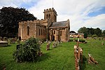
Stoke sub Hamdon Priory is a complex of buildings and ruins which initially formed a 14th-century college for the chantry chapel of St Nicholas, and later was the site of a farm in Stoke-sub-Hamdon, Somerset, England. The only building remaining from the college is a great hall and attached dwelling, dating from the late 15th century. The hall is designated by English Heritage as a Grade I listed building, while the outbuildings and gateway are Grade II listed. The whole site has been scheduled as an ancient monument. A number of the farm buildings are in poor condition, and have been added to the Heritage at Risk Register. The college was formed in 1304 as a chantry college, funded by John de Beauchamp, 1st Baron Beauchamp to serve the free chapel in his nearby manor house. Over the following 150 years, the college fell into disrepair and was rebuilt around 1460. During the dissolution, the land passed into the laity, and was a tenanted farm until the middle of the 20th century. The National Trust bought the property in 1946, and with the exception of the part of the house which is inhabited, the site is now open to the public. Despite being known as "The Priory", or "Stoke sub Hamdon Priory", the building has never been used as a priory, and there is no record of a monastic house in Stoke sub Hamdon.
Excerpt from the Wikipedia article Stoke sub Hamdon Priory (License: CC BY-SA 3.0, Authors, Images).Stoke sub Hamdon Priory
High Street,
Geographical coordinates (GPS) Address Nearby Places Show on map
Geographical coordinates (GPS)
| Latitude | Longitude |
|---|---|
| N 50.9545 ° | E -2.7488 ° |
Address
High Street
High Street
TA14 6PR
England, United Kingdom
Open on Google Maps


