place

Laurelhurst, Seattle
Neighborhoods in Seattle
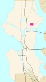
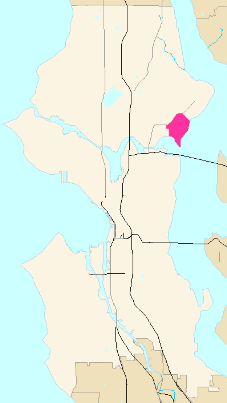
Seattle Map Laurelhurst

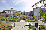
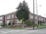
Laurelhurst is a residential neighborhood in Seattle, Washington, USA. It is bounded on the northeast by Ivanhoe Place N.E., beyond which is Windermere; on the northwest by Sand Point Way N.E. and N.E. 45th Street, beyond which are Hawthorne Hills, Ravenna, and University Village; on the west by Mary Gates Memorial Drive N.E., beyond which is the East Campus of the University of Washington; on the southwest by Union Bay; and on the east by Lake Washington. Seattle Children's Hospital is located in its northwest corner. Once a seasonal campground of the Duwamish people, the neighborhood has been a part of Seattle since its annexation in 1910.The community center is an official city landmark. The Laurelhurst Beach Club, Laurelhurst Park, and its Laurelhurst Community Center serve as gathering places. Laurelhurst has had several famous residents, including Melanie Griffith and Antonio Banderas, who rented a house on the waterfront one summer while filming a movie; musician Duff McKagan, bassist for Guns N' Roses. Bill Gates lived as a young child in Wallingford before moving to the neighborhood, where his father Bill Gates Sr. lived.The neighborhood is one of the most expensive in Seattle, with median home prices around $1,649,000, over double the overall Seattle median of $735,000, as of September 2018.

Excerpt from the Wikipedia article Laurelhurst, Seattle (License: CC BY-SA 3.0, Authors, Images).

Laurelhurst, Seattle
Northeast 44th Street, Seattle

Geographical coordinates (GPS) Address Nearby Places
placeShow on map

Wikipedia: Laurelhurst, SeattleContinue reading on Wikipedia

Geographical coordinates (GPS)

Latitude Longitude
N 47.660277777778 ° E -122.28 °
placeShow on map

Address

Northeast 44th Street 4327
98105 Seattle
Washington, United States
mapOpen on Google Maps

Seattle Map Laurelhurst
Share experience

Nearby Places

Bryant, Seattle
Bryant, Seattle

Bryant is a residential neighborhood in northeast Seattle, Washington. According to the City of Seattle's neighborhood maps (as pictured), it is bounded by 35th Avenue NE and NE 45th Place on the west, beyond which is Ravenna; Sand Point Way NE and 45th Ave NE on the east, beyond which are Laurelhurst and Windermere; and NE 75th Street and NE 65th Street on the north, beyond which are View Ridge and Wedgwood.The neighborhood is sometimes known as Ravenna-Bryant, due to its proximity to Ravenna Park. The Burke–Gilman Trail runs along the southern and eastern margins of the neighborhood, paralleling Blakeley Street, Union Bay Place, 45th Street, and Sand Point Way. Bryant Park is located on NE 65th Street at 40th Avenue NE. In late 2012 the Ravenna-Bryant association incorporated a small neighborhood bounded by 35th Avenue NE on the west, 40th Avenue NE on the east, NE 75th Street on the north, and NE 65th Street on the south. The area had previously been a 'donut hole' between the neighborhood belonging to the Ravenna-Bryant association and those of Wedgwood and View Ridge.The North East branch of the Seattle Public Library, is located at 35th Avenue NE and NE 68th Street. Bryant is also the home to Assumption Catholic Church, University Unitarian Church, Ravenna Methodist, which houses a local preschool cooperative, and three synagogues, Congregation Beth Shalom (Conservative) at 35th Avenue NE and NE 68th Street, Emmanuel Congregation (Modern Orthodox) on NE 65th Street and 35th Avenue NE, and Congregation Shaarei Tefilah–Lubavitch (Orthodox) on NE 65th Street and 43rd Avenue NE. Bryant Elementary School, the Nathan Eckstein Middle School, and the North East Library all have status as Seattle city landmarks, as does Fire Station #38 at 5503 33rd Avenue N.E.

Hawthorne Hills, Seattle

Hawthorne Hills is a residential neighborhood in Seattle, Washington. It is officially split between the neighborhoods of Bryant and Windermere, but is generally recognized as a distinct neighborhood. The northern boundary is Northeast 65th Street. The southern and eastern boundary is Sand Point Way. The western boundary is 40th Avenue Northeast. Hawthorne Hills is bounded on the north by View Ridge, on the east by Windermere, on the south by Laurelhurst, and on the west by Bryant. There is a sign for the neighborhood along Sand Point Way. The neighborhood is named after Hawthorne Kingsbury Dent, a prominent Seattle insurance executive in the early 1900s who owned most of what is now named Hawthorne Hills. However, before Dent sold his land in 1928, the area around 40th Ave NE at NE 55th Street was marked on maps as Keith, named after settler Jacob Keith who owned land there from 1880 to 1887. Keith Station was a stop on the Seattle, Lake Shore & Eastern Railroad, the site of which is now in the Burke-Gilman Playground Park just across the Burke-Gilman Trail from Metropolitan Market.According to a 2013 analysis by Seattle Met Magazine and Zillow of 101 Seattle neighborhoods, Hawthorne Hills has the second-highest median household income of any Seattle neighborhood ($111,671, behind only Laurelhurst), and ranks 6th of 98 in median home value. This analysis also indicated that Hawthorne Hills had the lowest crime rate of all 101 Seattle neighborhoods. Many streets in the neighborhood run against the standard north–south/west-east Seattle grid and are named after college towns (e.g., Stanford, Princeton, Purdue, etc.). University Circle Park, which has views to Downtown Seattle and the Space Needle, is at the center of these streets. The southern part of Hawthorne Hills includes a portion of the Burke-Gilman Trail. Hawthorne Hills is located about two miles east of the University District, and serves as a bedroom community for many University of Washington professors and staffers. The neighborhood is home to Seattle Fire Station 38, Metropolitan Market Sand Point, Bryant Neighborhood Playground, Burke-Gilman Playground Park, National Archives and Records, the Center for Spiritual Living, and Congregation Shaarei Tefilah-Lubavitch.

Union Bay Natural Area

The Union Bay Natural Area (UBNA) in Seattle, Washington, also known as Union Bay Marsh, is the restored remainder of the filled former Union Bay and Union Bay Marsh. It is located at the east end of the main University of Washington campus, south of NE 45th Street and west of Laurelhurst. Ravenna Creek is connected to University Slough (Drainage Canal), thence to Union Bay, and Lake Washington. Drainage Canal is one of three or four areas of open water connected with Lake Washington around Union Bay Marsh. The canal extends from NE 45th Street, between the driving range and IMA Sports Field 1, south to the bay, ending southeast of the Husky Ballpark baseball grandstand (northeast of the IMA Building). The Drainage Canal that carries Ravenna Creek past UBNA to Union Bay is locally sometimes called University Slough. The little grasslands, modest ponds, and lake shoreline of the UBNA is a sanctuary for birds (including double-crested cormorants, great blue herons, and eagles); turtles and frogs may be seen. The UBNA is notable for diverse habitats including a good-sized lake, small permanent ponds, seasonal ponds, woods, sample prairie, and marshland. The interfaces among these make the area particularly attractive for birdwatching, with more than 150 species of birds sighted. The canal or slough was part of a restoration of the wetlands called Union Bay Marsh that had been drained by the opening of the Montlake Cut of the Lake Washington Ship Canal (1916) and much of Union Bay filled by the Montlake Dump, (home of J. P. Patches, resident 1958–1981). Formerly the Montlake Landfill, University Dump, or Ravenna Landfill, it was used by the City of Seattle for residential and industrial solid waste from 1911 to 1966. It was fully closed five years later and overlaid with two feet of clean soil. Most of the land has been built upon by University Village (1956), UW athletic fields, buildings, and main parking lot E; the remainder comprises the UBNA, colloquially called "the fill". Before the lowering of Lake Washington during the early part of the 20th century, Ravenna and Yesler Creeks flowed into marshland north of where the canal now begins, and the land through which the canal would be cut lay under the waters of Union Bay. The Burke-Gilman Trail follows the Seattle, Lake Shore and Eastern Railway line along the original shoreline of Union Bay past the UW power plant and University Village. Construction was completed in 2006 on a project that reconnects partially daylighted Ravenna Creek to Union Bay by piping it underground to the canal, thus converting the upper reach from a relatively stagnant drainage to the outlet for one of Seattle's partially restored urban creeks. Daylighting from southeast Ravenna Park to the UW and the UBNA has been blocked by the owners of University VillageThe UBNA is owned by the State of Washington and held under the aegis of the University of Washington; access is controlled. Parts of the Area are open during park hours, access to other portions is discouraged, some portions seasonally, for habitat or species protection.Many restoration projects take place at UBNA. Removal of invasive species, such as Himalayan blackberry (Rubus armeniacus) and morning glory (Convolvulus arvensis), are part of a continual effort to restore the site to a natural area. Volunteers account for much of the progress in the Union Bay Natural Area.

Calvary Cemetery (Seattle)

Calvary Cemetery is a Roman Catholic cemetery in Seattle, Washington, United States, located in the Ravenna/Bryant neighborhood. Dedicated on December 1, 1889, it is situated on the southwest slope of a hill overlooking University Village, about a mile (1.6 km) northeast of the University of Washington. It is owned and operated by the Archdiocese of Seattle. Covering an area of 40 acres (16 ha), the square-shaped cemetery is bounded on the north by N.E. 55th Street, on the east by 35th Avenue N.E., on the south by N.E. 50th Street, and on the west by 30th Avenue N.E. Around 40,000 people are buried in its grounds, including: Vivian E. Albertson, Bellevue School District director from 1982 to 1990 Dave Beck, former president of the Teamsters "Tioga George" Burns, baseball player, the American League's most valuable player in 1926. John Cherberg, lieutenant governor for 32 years, UW football player and head coach Raymond E. Davis, Medal of Honor recipient in 1905 Hec Edmundson, basketball and track coach at the University of Washington Walter Galbraith, former president of Galbraith and Co. and director of Washington Mutual Tubby Graves, baseball head coach at UW Michael J. "Moose" Heney, Alaskan railroad builder Al Hostak, middleweight boxer Jacob Nist, founder of Queen City Manufacturing Company, now the Seattle-Tacoma Box Company Edward Nordhoff, founder of The Bon Marché department store chain William Piggott, founder of Paccar Albert Rosellini, former governorAdditionally, priests of the Archdiocese of Seattle and clergy from a number of religious orders are buried at the cemetery. There is one British Commonwealth war grave, of a Canadian Army soldier of World War I.