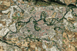
Fort San Cristóbal (Spain)
Buildings and structures in NavarreCarlismFortifications of the Spanish Civil WarForts in Spain

The Fort Alfonso XII or San Cristóbal is a fort located on the top of the mount San Cristóbal or Ezcaba (892,8 m above sea level), 4 km from Pamplona, Spain. It was erected following the 1872-1876 Carlist War to control an strategic point towering over Pamplona. It was later made into a makeshift prison during the 2nd Spanish Republic, bearing witness during Civil War to a halfhearted massive prison break by leftist prisoners that ended up with the death of hundreds.
Excerpt from the Wikipedia article Fort San Cristóbal (Spain) (License: CC BY-SA 3.0, Authors, Images).Fort San Cristóbal (Spain)
Camino del agua,
Geographical coordinates (GPS) Address External links Nearby Places Show on map
Geographical coordinates (GPS)
| Latitude | Longitude |
|---|---|
| N 42.857222222222 ° | E -1.6638888888889 ° |
Address
Fuerte de San Cristóbal / Alfontso XII.aren gotorlekua
Camino del agua
31013
Navarre, Spain
Open on Google Maps


