Lundtofte
Capital Region of Denmark stubsCities and towns in the Capital Region of DenmarkCopenhagen metropolitan areaLyngby-Taarbæk MunicipalityNeighbourhoods in Denmark

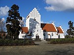
Lundtofte is a neighbourhood in Lyngby-Taarbæk Municipality, located north of Kongens Lyngby. The town is bordered by Nærumbanen, the Mølleåen river, the Technical University of Denmark and the Helsingørmotorvejen. DTU is situated on the location of the former Lundtofte Flyveplads. Major company Haldor Topsøe is located in Lundtofte. Catalysts by Haldor Topsøe are used in production of around 50% of the world's fertilizer.Lundtofte Church originates from 1921.
Excerpt from the Wikipedia article Lundtofte (License: CC BY-SA 3.0, Authors, Images).Lundtofte
Maglebjergvej, Lyngby-Taarbæk Municipality
Geographical coordinates (GPS) Address Nearby Places Show on map
Geographical coordinates (GPS)
| Latitude | Longitude |
|---|---|
| N 55.798611111111 ° | E 12.524166666667 ° |
Address
Maglebjergvej
2850 Lyngby-Taarbæk Municipality, Lundtofte
Capital Region of Denmark, Denmark
Open on Google Maps


