place

All Saints Episcopal Church (Saugatuck, Michigan)

19th-century Episcopal church buildingsBuildings and structures in Allegan County, MichiganCarpenter Gothic church buildings in MichiganChurches completed in 1874Churches on the National Register of Historic Places in Michigan
Episcopal church buildings in MichiganMichigan State Historic SitesNational Register of Historic Places in Allegan County, MichiganWooden churches in Michigan
All Saints Episcopal Church Saugatuck

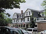
All Saints Episcopal Church, built in 1872–1873, is an historic Carpenter Gothic church in Saugatuck, Michigan. On February 27, 1984, it was added to the National Register of Historic Places.

Excerpt from the Wikipedia article All Saints Episcopal Church (Saugatuck, Michigan) (License: CC BY-SA 3.0, Authors, Images).

All Saints Episcopal Church (Saugatuck, Michigan)
Hoffman Street,

Geographical coordinates (GPS) Address Nearby Places
placeShow on map

Wikipedia: All Saints Episcopal Church (Saugatuck, Michigan)Continue reading on Wikipedia

Geographical coordinates (GPS)

Latitude Longitude
N 42.656388888889 ° E -86.200833333333 °
placeShow on map

Address

Hoffman Street 473
49453
Michigan, United States
mapOpen on Google Maps

All Saints Episcopal Church Saugatuck
Share experience

Nearby Places

Saugatuck Gap Filler Radar Annex

The Saugatuck Gap Filler Annex (ADC ID: P-67C, NORAD ID: Z-67C, Z-34G) is a decommissioned radar installation that once served in the vast Cold War era Semi-Automatic Ground Environment (SAGE) air defense system. Of the hundreds of SAGE radars, Saugatuck's is one of, perhaps, two that remain nearly completely intact. Located immediately across the Kalamazoo River from Saugatuck, Michigan, at the top of Mount Baldhead, a 230-foot dune on the shore of Lake Michigan, the annex was positioned to fill gaps in the coverage of long-range "heavy" radars sited further inland. The heavy radars searched for attacking Soviet bombers but were unable to detect aircraft flying low to the west of the dunes along Lake Michigan. Saugatuck's original AN/FPS-14 radar was commissioned in mid-1958 and operated until it was replaced with a more capable AN/FPS-18 in 1963. The FPS-18 radar served continuously until the site was decommissioned early in 1968. The city of Saugatuck purchased the building, tower, and radar equipment from the Air Force in 1969. Today, the installation appears very much as it did when operational with virtually all of the Cold War-era electronic equipment still in place. The Saugatuck Gap Filler Annex was listed on the National Register of Historic Places in 2022, and efforts are underway by a work group commissioned by the city of Saugatuck to stabilize the site and secure funding for further preservation and restoration.