Hermannskogel
DöblingGeodesyHills of ViennaPages including recorded pronunciationsPages with German IPA ... and 1 more
Vienna Woods

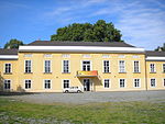
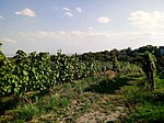
The Hermannskogel (German pronunciation: [ˈhɛʁmansˌkoːɡl̩] ) is a hill in Döbling, the 19th district of Vienna. At 542 metres above sea level, it is the highest natural point of Vienna. It lies on the border to Lower Austria. The Habsburgwarte, standing atop the Hermannskogel, marked the kilometre zero in cartographic measurements used in Austria-Hungary until 1918.
Excerpt from the Wikipedia article Hermannskogel (License: CC BY-SA 3.0, Authors, Images).Hermannskogel
Gustav-Fischer-Steig,
Geographical coordinates (GPS) Address Nearby Places Show on map
Geographical coordinates (GPS)
| Latitude | Longitude |
|---|---|
| N 48.266666666667 ° | E 16.283333333333 ° |
Address
Gustav-Fischer-Steig
Gustav-Fischer-Steig
1190 (Döbling)
Lower Austria, Austria
Open on Google Maps


