place

Alger, Washington

Census-designated places in Skagit County, WashingtonCensus-designated places in Washington (state)Use mdy dates from July 2023
Skagit County Washington Incorporated and Unincorporated areas Alger Highlighted

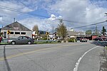
Alger is a census-designated place (CDP) in Skagit County, Washington, United States. The population was 403 at the 2010 census. It is included in the Mount Vernon–Anacortes, Washington Metropolitan Statistical Area. Alger is located along Old Highway 99 North Road. It is near the midway point of the route between Seattle and Vancouver, 76 miles from the former and 66 miles from the latter. A former logging camp, Alger is now a working-class exurban community and home to the Skagit Speedway. The nearby Skagit Speedway has been operating for 50 years and attracting racers from all over the Northwest and West; Kasey Kahne raced there before becoming a NASCAR Sprint Cup driver. It is a 1/3 mile banked oval track built of silica and clay, and the faster classes of sprint cars achieve lap averages of almost 100 mph. Races are typically held on Saturday nights under floodlights, and camping is available for racers and spectators in the Speedway's grounds.

Excerpt from the Wikipedia article Alger, Washington (License: CC BY-SA 3.0, Authors, Images).

Alger, Washington
Silver Run Lane, Bellingham

Geographical coordinates (GPS) Address Nearby Places
placeShow on map

Wikipedia: Alger, WashingtonContinue reading on Wikipedia

Geographical coordinates (GPS)

Latitude Longitude
N 48.623611111111 ° E -122.34388888889 °
placeShow on map

Address

Silver Run Lane 1475
98229 Bellingham
Washington, United States
mapOpen on Google Maps

Skagit County Washington Incorporated and Unincorporated areas Alger Highlighted
Share experience

Nearby Places

Lake Whatcom
Lake Whatcom

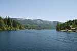
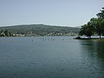
Lake Whatcom (from the Lummi word for "loud water") is located in Whatcom County, Washington, United States. It is the drinking water source for approximately 85,000 residents in the city of Bellingham as well as Whatcom County. It is approximately 10 miles (16 km) in length and 1 mile (1.6 km) in width at its widest. Lake Whatcom is located and managed within three political jurisdictions: the city of Bellingham, Whatcom County, and the Lake Whatcom Water and Sewer District. The lake is a popular area for motor boating, swimming, fishing, and other recreational activities. The lake is divided into three basins. Basin 1, the Silver Beach Basin, is the furthest north, and has a maximum depth of 100 feet (30 m). Land use in Basin 1 is primarily residential development, with one large park and several small parks. Basin 2, the Geneva Basin, is the central basin where the drinking water for the city of Bellingham is withdrawn. This basin is the shallowest, with a maximum depth of just 40 to 60 feet (12 to 18 m). Land use is primarily residential, with a mix of lake protection program properties and some rural forestry. Basin 3 is the southernmost basin and is the most remote. At its greatest depth, Basin 3 is 328 feet (100 m) deep, and is estimated to contain 96% of the lake's total water volume. Land use in Basin 3 is composed of scattered residential development, mostly in the community of Sudden Valley, as well as rural and commercial forestry. The total area of the Lake Whatcom Watershed is 142 square kilometers (55 sq mi). There are nine annual streams and approximately 25 additional small creeks and tributaries that flow into Lake Whatcom, accounting for 23 sub-watersheds in all. Lake Whatcom drains into Bellingham Bay by way of Whatcom Creek. The lake has only one island, the 3-acre (12,000 m2) Reveille Island, owned by Camp Firwood, which is believed to be the site of past ceremonies by Native Americans, due to the presence of pictographs and a zoomorphic stone bowl found on the island.