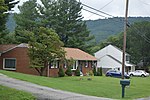
place

Laymantown, Virginia

Census-designated places in Botetourt County, VirginiaCensus-designated places in VirginiaUse mdy dates from July 2023

Laymantown is a census-designated place (CDP) in southern Botetourt County, Virginia, United States. The population was 1,867 at the 2020 census. The community is located along State Route 658 (Laymantown Road). It is part of the Roanoke Metropolitan Statistical Area.

Excerpt from the Wikipedia article Laymantown, Virginia (License: CC BY-SA 3.0, Authors).

Laymantown, Virginia
Laymantown Road,

Geographical coordinates (GPS) Address Nearby Places
placeShow on map

Wikipedia: Laymantown, VirginiaContinue reading on Wikipedia

Geographical coordinates (GPS)

Latitude Longitude
N 37.360277777778 ° E -79.848888888889 °
placeShow on map

Address

Laymantown Road 997
24175
Virginia, United States
mapOpen on Google Maps

Share experience

Nearby Places

Mount Moriah Baptist Church and Cemetery

Mount Moriah Baptist Church and Cemetery is a historic African-American Baptist church and cemetery located at Roanoke, Virginia. It was built about 1908, and is a small, one-story, rectangular frame church sheathed in weatherboard. It consists of a main sanctuary, a front vestibule, and a rear chancel bay. The frame building sits on a raised foundation of uncoursed fieldstones. The associated burial ground contains over 100 interments from the 1870s through the present.It was listed on the National Register of Historic Places in 1994.Outside the entrance to the church is an historical marker that reads: "Mount Moriah Baptist Church. K-99. The members of Mount Moriah Baptist Church belong to one of the region's earliest African American congregations, originating in a Sunday school for slaves established in the mid-1800s by Dr. Charles L. Cocke, founder of Hollins College. The group gained permission in 1858 to build its first church. The present church, the congregation's third, was built about 1908. It was added to the National Register of Historic Places and the Virginia Landmarks Register in 1994. The nearby cemetery was expanded from a former slave burial ground.""There are many unmarked graves at this location. The listing of names is complete as of 19 June 2007."Recent upgrades in the church property included a new paved driveway from the City of Roanoke, and new kitchen and bathroom facilities, donated by local churches, individuals and organizations.