Boulderclough
Use British English from March 2015Villages in West YorkshireWest Yorkshire geography stubs

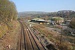
Boulderclough is a small village in the Borough of Calderdale in West Yorkshire, England. The village is situated between Sowerby at the south and Mytholmroyd at the north, and is approximately 3 miles (5 km) west from the centre of the town of Halifax. The village contains a chapel. The village public house closed some years ago; the nearest pub is at Sowerby Castle Hill half-a-mile to the south-east. There are footpaths, and a river that runs by a small woodland area.
Excerpt from the Wikipedia article Boulderclough (License: CC BY-SA 3.0, Authors, Images).Boulderclough
Shield Hall Lane, Calderdale
Geographical coordinates (GPS) Address Nearby Places Show on map
Geographical coordinates (GPS)
| Latitude | Longitude |
|---|---|
| N 53.7102 ° | E -1.94996 ° |
Address
Shield Hall Lane
Shield Hall Lane
HX6 1NJ Calderdale
England, United Kingdom
Open on Google Maps


