place

Brownhills Watling Street railway station

Disused railway stations in WalsallFormer Midland Railway stationsPages with no open date in Infobox stationRailway stations in Great Britain closed in 1930Railway stations in Great Britain opened in 1884
Use British English from January 2017West Midlands (county) building and structure stubsWest Midlands (region) railway station stubs
BrownhillsWatlingStreet

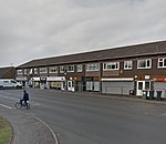
Brownhills Watling Street railway station was a station on the Midland Railway in England. It was opened in 1884, closed in March 1930 for passenger use and the track was closed in 1960.It opened as simply Brownhills railway station, which was also the name of the other station within the town, which was operated by the London and North Western Railway on the South Staffordshire Line. The station was renamed in 1924.The branch line that the station was situated on was planned to access the colliery traffic in the Cannock area and to link to the Cannock Chase and Wolverhampton Railway, and passenger traffic was a secondary consideration. The station was the terminus of passenger services on the line but freight traffic continued northwards to serve the collieries in the area. The line to the north of the station is now in use as part of the Chasewater Railway.

Excerpt from the Wikipedia article Brownhills Watling Street railway station (License: CC BY-SA 3.0, Authors, Images).

Brownhills Watling Street railway station
Coppice Lane,

Geographical coordinates (GPS) Address Nearby Places
placeShow on map

Wikipedia: Brownhills Watling Street railway stationContinue reading on Wikipedia

Geographical coordinates (GPS)

Latitude Longitude
N 52.6534 ° E -1.9436 °
placeShow on map

Address

Brownhills Common

Coppice Lane
WS8 7JN , Shire Oak
England, United Kingdom
mapOpen on Google Maps

BrownhillsWatlingStreet
Share experience

Nearby Places

Brownhills
Brownhills

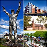
Brownhills is a town and former administrative centre in the Metropolitan Borough of Walsall, West Midlands, England. A few miles south of Cannock Chase and close to the large Chasewater reservoir, it is 6 miles (9.7 km) northeast of Walsall, a similar distance southwest of Lichfield and 13 miles (20.9 km) miles north-northwest of Birmingham. It is part of the Aldridge-Brownhills parliamentary constituency and neighbours the large suburban villages of Pelsall and Walsall Wood. It lies within the boundaries of the historic county of Staffordshire. The town lies close to the route of the ancient Watling Street, and although there is no record of its existence before the 17th century, Ogley Hay – a district of the town today – is recorded as a settlement in the Domesday Book. Brownhills quickly grew around the coal-mining industry, especially after the town became linked to the canal and railway networks in the mid-19th century. By the end of the century, Brownhills had grown from a hamlet of only 300 inhabitants to a town of more than 13,000, of whom the vast majority were employed in the coal industry. Mining remained the town's principal industry until the 1950s; the subsequent closure of the pits led to a severe economic decline that has continued until the present. The local authority instituted a regeneration programme in 2007, which was hoped would revive the town's fortunes, but there has been little subsequent development.