Hawcoat
Wards of Barrow-in-Furness

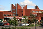
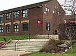
Hawcoat is an area and electoral ward of Barrow-in-Furness, Cumbria, England. Historically part of Lancashire, it is one of Barrow's most northerly wards and is bordered by Roose, Newbarns, Parkside, Ormsgill and the town of Dalton-in-Furness to the north.
Excerpt from the Wikipedia article Hawcoat (License: CC BY-SA 3.0, Authors, Images).Hawcoat
Dalton Lane,
Geographical coordinates (GPS) Address Nearby Places Show on map
Geographical coordinates (GPS)
| Latitude | Longitude |
|---|---|
| N 54.137 ° | E -3.214 ° |
Address
Dalton Lane 85
LA14 4LB , Hawcoat
England, United Kingdom
Open on Google Maps


