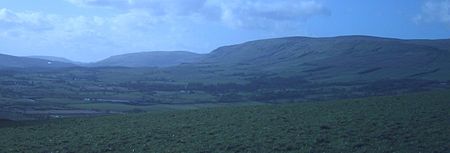
Campsie Fells
Carboniferous volcanismHills of the Scottish Midland ValleyMountain ranges of ScotlandMountains and hills of East DunbartonshireMountains and hills of Stirling (council area) ... and 1 more
Volcanoes of Scotland

The Campsie Fells (also known as the Campsies; Scottish Gaelic: Monadh Chamaisidh) are a range of hills in central Scotland, stretching east to west from Denny Muir to Dumgoyne in Stirlingshire and overlooking Strathkelvin to the south. The southern extent of the range falls within East Dunbartonshire. The range overlooks the villages of Strathblane, Blanefield, Milton Of Campsie, Lennoxtown and Torrance to the south; Killearn to the west, and Fintry and Strathendrick to the north. The Fintry Hills lie further to the north; Kilpatrick Hills lie to the west and the Kilsyth Hills to the east.
Excerpt from the Wikipedia article Campsie Fells (License: CC BY-SA 3.0, Authors, Images).Campsie Fells
Geographical coordinates (GPS) Address Nearby Places Show on map
Geographical coordinates (GPS)
| Latitude | Longitude |
|---|---|
| N 56.016666666667 ° | E -4.3 ° |
Address
Strathblane
G63 9BE
Scotland, United Kingdom
Open on Google Maps


