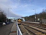
A631 road
Bassetlaw DistrictEast Lindsey DistrictGeographic coordinate listsInfobox road instances in the United KingdomInfobox road maps tracking category ... and 10 more
Lists of coordinatesRoads in EnglandRoads in LincolnshireRoads in NottinghamshireRoads in YorkshireRotherhamTransport in South YorkshireUse British English from February 2013West Lindsey DistrictWikipedia external links cleanup from October 2022

The A631 is a road running from Sheffield, South Yorkshire to Louth, Lincolnshire in England. It passes through the counties of South Yorkshire, Nottinghamshire and Lincolnshire. The road has many towns on its route including Rotherham, Maltby, Gainsborough and Market Rasen. It is mostly single road throughout its length but has some stretches of dual carriageway as well.
Excerpt from the Wikipedia article A631 road (License: CC BY-SA 3.0, Authors, Images).A631 road
Thorndike Way, West Lindsey
Geographical coordinates (GPS) Address Nearby Places Show on map
Geographical coordinates (GPS)
| Latitude | Longitude |
|---|---|
| N 53.3932 ° | E -0.76 ° |
Address
Thorndike Way
Thorndike Way
DN21 1NT West Lindsey
England, United Kingdom
Open on Google Maps


