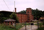
place

Utica, South Carolina

Census-designated places in Oconee County, South CarolinaCensus-designated places in South CarolinaUse mdy dates from July 2023
Oconee County South Carolina incorporated and unincorporated areas Utica highlighted

Utica is a census-designated place (CDP) in Oconee County, South Carolina, United States. The population was 1,322 at the 2000 census.

Excerpt from the Wikipedia article Utica, South Carolina (License: CC BY-SA 3.0, Authors, Images).

Utica, South Carolina
Humbert Street,

Geographical coordinates (GPS) Address Nearby Places
placeShow on map

Wikipedia: Utica, South CarolinaContinue reading on Wikipedia

Geographical coordinates (GPS)

Latitude Longitude
N 34.678055555556 ° E -82.928611111111 °
placeShow on map

Address

Humbert Street 40
29678
South Carolina, United States
mapOpen on Google Maps

Oconee County South Carolina incorporated and unincorporated areas Utica highlighted
Share experience

Nearby Places

Keowee River

The Keowee River is created by the confluence of the Toxaway River and the Whitewater River in northern Oconee County, South Carolina. The confluence is today submerged beneath the waters of Lake Jocassee, a reservoir created by Lake Jocassee Dam. The Keowee River flows out of Lake Jocassee Dam and into Lake Keowee, a reservoir created by Keowee Dam and Little River Dam. The Keowee River flows out of Keowee Dam to join Twelvemile Creek near Clemson, South Carolina, forming the beginning of the Seneca River, a tributary of the Savannah River. The Keowee River is 25.7 miles (41.4 km) long.The boundary between the Seneca River and the Keowee River has changed over time. In the Revolutionary War period and early eighteenth century, the upper part of the Seneca River was often called the Keowee River, as it was part of the Cherokee homeland. They also had a town named Keowee.In current times, the section of the Keowee River between the Keowee Dam and its confluence with Twelvemile Creek is called the Seneca River on many maps, including the official county highway map. Since this area is flooded by Lake Hartwell, formed by damming the Seneca and Tugaloo rivers, it is natural to refer to this section as the Seneca instead of its proper name. By the early eighteenth century the Cherokee occupied several towns along the upper Keowee River, which were referred to as the Lower Towns. These had long been occupied by indigenous peoples, and each of the larger towns had an earthwork platform mounds built by ancestral people of the South Appalachian Mississippian culture era. The Cherokee typically constructed townhouses, which were their form of public architecture, on top of such mounds if available. Keowee was the principal town of the Lower Towns. Other Cherokee towns on the Keowee River included Etastoe (also spelled Estatoe), and Sugartown (Kulsetsiyi).

Isunigu

Isunigu (also called Seneca, Esseneca, and Sinica) was a Cherokee town on the Keowee River. It was on the west side of the Keowee River, near the mouth of Coneross Creek, in today's Oconee County, South Carolina. Present-day Clemson and Seneca, South Carolina later developed near here. During the colonial period, Isunigu was classified by English traders and colonists as one of the Cherokee "Lower Towns", a geographical grouping that included Piedmont towns along the Keowee River in southwestern South Carolina and towns along the Tugaloo River in northeastern Georgia. The principal town of this grouping was considered to be Keowee, on the river of the same name. In the late 18th and early 19th centuries, the Cherokee ceded their land of the Lower Towns to South Carolina. Andrew Pickens developed his "Hopewell" plantation on the east side of the Keowee River. Following the American Revolution and conflict between the Cherokee and European Americans, this was where the 1785 Treaty of Hopewell was signed by both parties. The site of Isunigu, a settlement that likely had more than a thousand years of previous indigenous habitation, as did other towns in the area, was flooded by the creation in the 20th century of Lake Hartwell. It was formed as the reservoir behind Hartwell Dam on the Keowee River. The meaning of the name Isunigu is lost, along with the artifacts and other materials from prehistoric and historic years now submerged under Lake Hartwell.