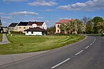
Severozápad
NUTS 2 statistical regions of the European UnionSubdivisions of the Czech Republic

Severozápad (Northwest) is a statistical area of the Nomenclature of Territorial Units for Statistics, level NUTS 2. It includes the Karlovy Vary Region and Ústí nad Labem Region. It covers an area of 8 649 km2 and 1,120,654 inhabitants (population density 130 inhabitants/km2).
Excerpt from the Wikipedia article Severozápad (License: CC BY-SA 3.0, Authors, Images).Severozápad
25116, okres Chomutov
Geographical coordinates (GPS) Address Nearby Places Show on map
Geographical coordinates (GPS)
| Latitude | Longitude |
|---|---|
| N 50.416666666667 ° | E 13.5 ° |
Address
25116
431 43 okres Chomutov, Nezabylice
Czechia
Open on Google Maps


