place

Roe Island

Islands of Northern CaliforniaIslands of Solano County, CaliforniaIslands of Suisun BayIslands of the San Francisco Bay AreaSan Francisco Bay Area geography stubs
Aerial view of Carquinez Strait 2 (cropped) (cropped)

Roe Island is an island in Suisun Bay at the mouth of the Sacramento-San Joaquin River Delta in Solano County, California, 10 km east of Benicia. Its western tip is named Preston Point, and its eastern tip is Gillespie Point. It is shown, labeled "Preston Island", on an 1850 survey map of the San Francisco Bay area made by Cadwalader Ringgold and an 1854 map of the area by Henry Lange. It is labeled, along with Deadman Island, Joice Island, Grizzly Island, Simmons Island and Ryer Island, on a 1902 USGS map of the area.On November 22, 2010, Brian Hopper was rescued from Roe Island by the U.S. Coast Guard. He had been stranded on the island for five days (after his rubber raft sprung a leak), before using his cell phone to contact a cousin, who notified the Coast Guard.

Excerpt from the Wikipedia article Roe Island (License: CC BY-SA 3.0, Authors, Images).

Geographical coordinates (GPS)

Latitude Longitude
N 38.0725 ° E -122.03472222222 °
placeShow on map

Address

Solano County (Solano)


California, United States
mapOpen on Google Maps

Aerial view of Carquinez Strait 2 (cropped) (cropped)
Share experience

Nearby Places

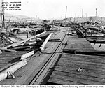
Port Chicago disaster

The Port Chicago disaster was a deadly munitions explosion of the ship SS E. A. Bryan on July 17, 1944, at the Port Chicago Naval Magazine in Port Chicago, California, United States. Munitions while being loaded onto a cargo vessel bound for the Pacific Theater of Operations, detonated killing 320 sailors and civilians and injuring 390 others. Two-thirds of the dead and injured were enlisted African American sailors. A month later, the unsafe conditions prompted hundreds of servicemen to refuse to load munitions, an act known as the Port Chicago Mutiny. Fifty men‍—‌called the "Port Chicago 50"‍—‌were convicted of mutiny and sentenced to 15 years of prison and hard labor, as well as a dishonorable discharge. Forty-seven of the 50 were released in January 1946; the remaining three served additional months in prison. During and after the mutiny court-martial, questions were raised about the fairness and legality of the proceedings. Owing to public pressure, the United States Navy reconvened the courts-martial board in 1945—that board re-affirmed convictions. Widespread publicity surrounding the case turned it into a cause célèbre among Americans opposing discrimination targeting African Americans; it and other race-related Navy protests of 1944–45 led the Navy to change its practices and initiate the desegregation of its forces beginning in February 1946. In 1994, the Port Chicago Naval Magazine National Memorial was dedicated to the lives lost in the disaster.

Suisun Bay
Suisun Bay

Suisun Bay ( sə-SOON; Wintun for "where the west wind blows") is a shallow tidal estuary (a northeastern extension of the San Francisco Bay) in Northern California. It lies at the confluence of the Sacramento River and San Joaquin River, forming the entrance to the Sacramento–San Joaquin River Delta, an inverted river delta. To the west, Suisun Bay is drained by the Carquinez Strait, which connects to San Pablo Bay, a northern extension of San Francisco Bay. Grizzly Bay forms a northern extension of Suisun Bay. Suisun Bay is between Contra Costa County to the south and Solano County to the north. The bay was named in 1811, after the Suisunes, a Patwin tribe of Wintun Indians. The Central Pacific Railroad built a train ferry that operated between Benicia and Port Costa, California, from 1879 to 1930. The ferry boats Solano and Contra Costa were removed from service when the nearby Martinez railroad bridge was completed in 1930. From 1913 until 1954 the Sacramento Northern Railway, an electrified interurban line, crossed Suisun Bay with the Ramon, a distillate-powered train ferry. On April 28, 2004, a petroleum pipeline operated by Kinder Morgan Energy Partners ruptured, initially reported as spilling 1,500 barrels (264m³) of diesel fuel in the marshes, but, this was later updated to about 2,950 barrels. Kinder Morgan pleaded guilty to operating a corroded pipeline (and cited for failing to notify authorities quickly after the spill was discovered) and paid three million dollars in penalties and restitution.