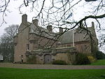
Doonie Point
Aberdeenshire stubsClimbing areas of ScotlandHeadlands of ScotlandLandforms of AberdeenshireScottish sports venue stubs ... and 1 more
Use British English from February 2018

Doonie Point is a rocky headland situated approximately 1.5 kilometres south of the village of Muchalls in Aberdeenshire, Scotland. The clifftop of Doonie Point yields views to the north of Grim Brigs, Brown Jewel and the coast of Newtonhill. To the south are views of the Castle Rock of Muchalls and the rugged North Sea coastline toward Stonehaven. Notable historic structures in the vicinity of Doonie Point are the Chapel of St. Mary and St. Nathalan, Muchalls Castle and the Mill of Muchalls. This site is a recognised rock climbing venue. Doonie Point is catalogued within the marine rescue activities for this part of the coast of northeast Scotland.
Excerpt from the Wikipedia article Doonie Point (License: CC BY-SA 3.0, Authors, Images).Doonie Point
Muchalls Bends,
Geographical coordinates (GPS) Address Nearby Places Show on map
Geographical coordinates (GPS)
| Latitude | Longitude |
|---|---|
| N 57.0108 ° | E -2.1636 ° |
Address
Muchalls Bends
AB39 3RQ
Scotland, United Kingdom
Open on Google Maps


