High Legh
Civil parishes in CheshireEngvarB from June 2016Villages in Cheshire

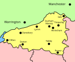
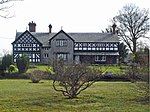
High Legh is a village, civil and ecclesiastical parish in the unitary authority of Cheshire East and the ceremonial county of Cheshire, England. It is Six miles (10 km) north west of Knutsford, seven miles (11 km) east of Warrington and twelve miles (19 km) south west of Manchester City Centre. The population of the entire civil parish was estimated at 1,705 in 2019.
Excerpt from the Wikipedia article High Legh (License: CC BY-SA 3.0, Authors, Images).High Legh
Pheasant Walk,
Geographical coordinates (GPS) Address Nearby Places Show on map
Geographical coordinates (GPS)
| Latitude | Longitude |
|---|---|
| N 53.352 ° | E -2.451 ° |
Address
Pheasant Walk
Pheasant Walk
WA16 6NB , High Legh
England, United Kingdom
Open on Google Maps


