place

Fairchance, Pennsylvania

1889 establishments in PennsylvaniaBoroughs in Fayette County, PennsylvaniaPittsburgh metropolitan areaPopulated places established in 1889Use mdy dates from October 2023
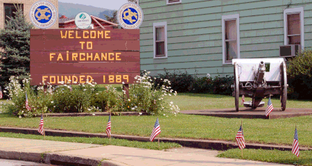
WelcomeToFairchance
WelcomeToFairchance

Fairchance is a borough in Fayette County, Pennsylvania, United States. The population was 1,889 at the 2020 census, a decline from the figure of 1,975 tabulated in 2010. It is served by the Albert Gallatin Area School District.

Excerpt from the Wikipedia article Fairchance, Pennsylvania (License: CC BY-SA 3.0, Authors, Images).

Fairchance, Pennsylvania
North Morgantown Street,

Geographical coordinates (GPS) Address Nearby Places
placeShow on map

Wikipedia: Fairchance, PennsylvaniaContinue reading on Wikipedia

Geographical coordinates (GPS)

Latitude Longitude
N 39.823888888889 ° E -79.754722222222 °
placeShow on map

Address

North Morgantown Street 84
15436
Pennsylvania, United States
mapOpen on Google Maps

WelcomeToFairchance
WelcomeToFairchance
Share experience

Nearby Places

Albert Gallatin Area School District

The Albert Gallatin Area School District is a large, rural, public school district located in Fayette County, Pennsylvania. It is named after Albert Gallatin former U.S. Secretary of the Treasury, planner of the Lewis and Clark expedition, engineer of the financial details of the Louisiana Purchase, and founder of New York University. It serves the Boroughs of Masontown, Fairchance, Point Marion, and Smithfield. It also serves German, Springhill, Georges, and Nicholson Townships. It encompasses approximately 142 square miles (370 km2). According to 2000 US federal census data, Albert Gallatin Area School District serves a resident population of 25,282. By 2010, the District's population declined to 23,852 people. The educational attainment levels for the Albert Gallatin Area School District population (25 years old and over) were 82.4% high school graduates and 11.9% college graduates. The district is one of the 500 public school districts of Pennsylvania. According to the Pennsylvania Budget and Policy Center, 61.4% of Albert Gallatin Area School District's pupils lived at 185% or below the Federal Poverty Level [1] as shown by their eligibility for the federal free or reduced price school meal programs in 2012. In 2013, the Pennsylvania Department of Education, reported that 24 students in the Albert Gallatin Area School District were homeless.In 2009, Albert Gallatin Area School District residents’ per capita income was $14,454, while the median family income was $31,607. In the Commonwealth, the median family income was $49,501 and the United States median family income was $49,445, in 2010. In Fayette County, the median household income was $39,115. By 2013, the median household income in the United States rose to $52,100. In 2014, the median household income in the USA was $53,700.Albert Gallatin Area High School is part of the Albert Gallatin Area School District is located 7 miles (11 km) south of Uniontown in York Run. The southern end of the Albert Gallatin School District borders West Virginia and Pittsburgh is approximately 50 miles (80 km) north of the high school. Morgantown, West Virginia is 20 miles (32 km) to the south. Recent building improvements include a state-of-the-art stadium grass playing fieldThe school mascot is the Colonial. The school is locally known by its initials, AG.
Fort Gaddis
Fort Gaddis

Fort Gaddis is the oldest known building in Fayette County, Pennsylvania and the second oldest log cabin in Western Pennsylvania. It is located 300 yards (270 m) east of old U.S. Route 119, near the Route 857 intersection in South Union Township, Pennsylvania (east of Hopwood and south of Uniontown). Fort Gaddis was built about 1769-74 by Colonel Thomas Gaddis who was in charge of the defense of the region, and his home was probably designated as a site for community meetings and shelter in times of emergency, hence the term "Fort Gaddis," probably a 19th-century appellation. It is a 1 1/2-story, 1-room log structure measuring 26 feet long and 20 feet wide.During the Whiskey Rebellion a Liberty Pole was erected at the house during a rally in support of the rebel cause. The choice of this site for a political demonstration indicates its importance as a focal point for community expression. The fact that all the additions to the building were removed in the early twentieth century in respect for the section contemporary with the American Revolution and Whiskey Rebellion is evidence of the building's longstanding and continuing status and power as a community symbol. Fort Gaddis was built near the Catawba Trail, an important north-south route that extended from New York to Tennessee and passed through Uniontown, Pennsylvania and Morgantown, West Virginia. In the 19th century the trail became locally known as the Morgantown Road. It is now Old U.S. Route 119. About 2 miles north on this road is Uniontown, the Fayette County, Pennsylvania seat, settled in the late 1760s and founded in July 1776 as Beeson's Mill.History fans and researchers should be aware that, depending on which sources are consulted, Fort Gaddis can also be known as the "Thomas Gaddis Homestead", the "Thomas Gaddis House" or "Gaddis' Fort". It was added to the National Register of Historic Places in 1974 as the Thomas Gaddis Homestead.