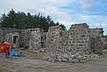
Craggie Cat
Aberdeenshire geography stubsMountains and hills of Aberdeenshire
Craggie Cat is a hill landform in the Mounth of the Grampian Mountains at the southern edge of Netherley, Aberdeenshire, Scotland. The peak elevation of Craggie Cat is 198 metres according to the Ordnance Survey. This hill's southwestern flanks form the northwest boundary of the moorland of Curlethney Hill.
Excerpt from the Wikipedia article Craggie Cat (License: CC BY-SA 3.0, Authors).Craggie Cat
Geographical coordinates (GPS) Address Nearby Places Show on map
Geographical coordinates (GPS)
| Latitude | Longitude |
|---|---|
| N 57.0255 ° | E -2.2523 ° |
Address
AB39 3QJ
Scotland, United Kingdom
Open on Google Maps


