Chewton Mendip
Civil parishes in SomersetMendip HillsVillages in Mendip DistrictWaldegrave family

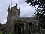
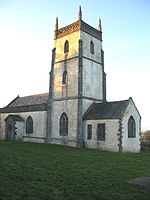
Chewton Mendip is a village and civil parish in the Mendip district of Somerset, England. It is situated 4 miles (6 km) north of Wells, 16 miles (26 km) south of Bath and Bristol on the A39 very close to the A37. The village is in a valley on the Mendip Hills and is the source of the River Chew. The parish includes the hamlets of Bathway and Green Ore.
Excerpt from the Wikipedia article Chewton Mendip (License: CC BY-SA 3.0, Authors, Images).Chewton Mendip
Puppy Lane, Mendip Chewton Mendip
Geographical coordinates (GPS) Address Nearby Places Show on map
Geographical coordinates (GPS)
| Latitude | Longitude |
|---|---|
| N 51.2755 ° | E -2.577 ° |
Address
Puppy Lane
Puppy Lane
BA3 4LH Mendip, Chewton Mendip
England, United Kingdom
Open on Google Maps


