Bridgerule
AC with 0 elementsCivil parishes in DevonTorridge DistrictVillages in Devon

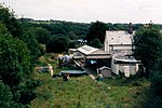
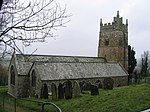
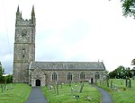
Bridgerule (Cornish: Ponsrowald) is a village and civil parish in Devon, England, a mile from the border with Cornwall. The parish is divided by the River Tamar, which no longer forms the border between Devon and Cornwall there. The river often floods the High Street. An electoral ward exists in the area titled Tamarside. The population at the 2011 census was 1,734
Excerpt from the Wikipedia article Bridgerule (License: CC BY-SA 3.0, Authors, Images).Bridgerule
Torridge District
Geographical coordinates (GPS) Address Nearby Places Show on map
Geographical coordinates (GPS)
| Latitude | Longitude |
|---|---|
| N 50.79 ° | E -4.45 ° |
Address
Chapel Corner
EX22 7EN Torridge District
England, United Kingdom
Open on Google Maps


