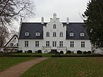
Espergærde
Espergærde is a town situated in North Zealand near Øresund in Denmark and is statistically considered part of the larger urban area Espergærde-Snekkersten-Elsinore, some 5 to 8 km south of the centre of Elsinore and in reality separated from the urban area of Elsinore-Snekkersten by a 100 m wide unbuilt area, Egebæksvang forest and area under natural protection around Flynderupgård (previously a village, later a farm, today a museum). The urban area of Espergærde also covers the two former villages Tibberup and Mørdrup and part of the former fishing village of Skotterup, with 11.524 inhabitants (2008). Espergærde is well limited to the north by Egebæksvang forest and Flynderupgård, to the west by Rolighedsmoserne (swamp area) and Helsingørmotorvejen (motorway or highway), to the south by Krogerup mansion fields and Babyloneskoven (Babylone forest). Espergærde is part of Region Hovedstaden (the capital area). Espergærde has its own postal number, 3060, and is split in two parishes: Egebæksvang Parish (church nearby the old fishermans village) and Mørdrup Parish (church next to the urban centre).
Excerpt from the Wikipedia article Espergærde (License: CC BY-SA 3.0, Authors).Espergærde
Hvidestensvej, Helsingør Municipality
Geographical coordinates (GPS) Address Nearby Places Show on map
Geographical coordinates (GPS)
| Latitude | Longitude |
|---|---|
| N 56 ° | E 12.566666666667 ° |
Address
Hvidestensvej
Hvidestensvej
3070 Helsingør Municipality
Capital Region of Denmark, Denmark
Open on Google Maps


