Copenhagen metropolitan area

The Copenhagen metropolitan area or Metropolitan Copenhagen (Danish: Hovedstadsområdet, pronounced [ˈhoːð̩stæðsʌmˌʁɔːðət], literally "The Capital Area") is a large commuter belt (the area in which it is practical to commute to work) surrounding Copenhagen, the capital of Denmark. It includes Copenhagen Municipality, Frederiksberg and surrounding municipalities stretching westward across Zealand. It has a densely-populated core surrounded by suburban settlements. The metropolitan area has several current definitions and also some historical, now defunct, definitions. The most widely accepted is the area which is strategically managed by the Finger Plan. The modern post 2007 version includes the four provinces Københavns by (Copenhagen city), Københavns omegn, Nordsjælland and Østsjælland, with a total land area of 2 778 km² and over 2 million inhabitants (16 March 2018;updated statistics from 1 January 2018 on cities (Danish byer, (singular) by) published later). It should not be confused with the Øresund Region or the Capital Region of Denmark.
Excerpt from the Wikipedia article Copenhagen metropolitan area (License: CC BY-SA 3.0, Authors, Images).Copenhagen metropolitan area
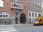
Larslejsstræde, Copenhagen Vesterbro
Geographical coordinates (GPS) Address Phone number Website Nearby Places Show on map
Geographical coordinates (GPS)
| Latitude | Longitude |
|---|---|
| N 55.68 ° | E 12.57 ° |
Address
St. Petri Skole
Larslejsstræde
1451 Copenhagen, Vesterbro
Capital Region of Denmark, Denmark
Open on Google Maps


