place

Oberwies

Municipalities in Rhineland-PalatinateRhein-Lahn-KreisRhein-Lahn-Kreis geography stubs
Oberwies in EMS
Oberwies in EMS

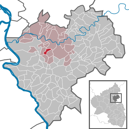
Oberwies is a municipality in the district of Rhein-Lahn, in Rhineland-Palatinate, in western Germany. It belongs to the association community of Bad Ems-Nassau.

Excerpt from the Wikipedia article Oberwies (License: CC BY-SA 3.0, Authors, Images).

Oberwies
Oberstraße, Bad Ems-Nassau

Geographical coordinates (GPS) Address Nearby Places
placeShow on map

Wikipedia: OberwiesContinue reading on Wikipedia

Geographical coordinates (GPS)

Latitude Longitude
N 50.288611111111 ° E 7.7805555555556 °
placeShow on map

Address

Oberstraße

Oberstraße
56379 Bad Ems-Nassau
Rhineland-Palatinate, Germany
mapOpen on Google Maps

Oberwies in EMS
Oberwies in EMS
Share experience

Nearby Places

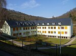
Scheuern Foundation
Scheuern Foundation

The Scheuern Foundation (German: Stiftung Scheuern) is a diaconal institution for the disabled. It cares for people with intellectual disabilities, acquired brain damage, and mental illness. The Scheuern Foundation supports these groups of people with a wide range of services, from individual forms of housing, education, and training to jobs in sheltered workshops and in local companies. It also focuses on therapeutic support for people with disabilities, day and leisure activities, guest care as part of preventative care, and much more. The Scheuern Foundation, a civil law charitable organization, is headquartered in the Scheuern district of Nassau. Along with several listed buildings located there, the foundation manages numerous other homes in the Rhine-Lahn-Westerwald region. It has approximately 1200 employees and is a member of both Diakonie Hessen and the Bundesverband Evangelische Behindertenhilfe (BeB) (Federal Association of Protestant Disability Assistance). The Scheuern Foundation has a long and eventful history dating back to its establishment in 1850, with some of its buildings being significantly older. During the National Socialist era, the Scheuern Foundation was the only institution associated with the Inner Mission to serve as an intermediate institution for the Nazi killing center Hadamar, setting a precedent with its takeover. For over 1500 people, the Scheuern Foundation was the last stop before they were murdered. During this time, 153 individuals died within the facilities of the Scheuern Foundation. The post-war era until the 1980s saw a modification in the attitude towards disabled individuals in society. There was no conscious confrontation with the National Socialist past until the mid-1990s. There have been ongoing structural changes up until the present year of 2020 and beyond.

Limes Germanicus

The Limes Germanicus (Latin for Germanic frontier) is the name given in modern times to a line of frontier (limes) fortifications that bounded the ancient Roman provinces of Germania Inferior, Germania Superior and Raetia, dividing the Roman Empire and the unsubdued Germanic tribes from the years 83 to about 260 AD. The Limes used either a natural boundary such as a river or typically an earth bank and ditch with a wooden palisade and watchtowers at intervals. A system of linked forts was built behind the Limes. The path of the limes changed over time following advances and retreats due to pressure from external threats. At its height, the Limes Germanicus stretched from the North Sea outlet of the Rhine to near Regensburg (Castra Regina) on the Danube. These two major rivers afforded natural protection from mass incursions into imperial territory, with the exception of a gap stretching roughly from Mogontiacum (Mainz) on the Rhine to Castra Regina. The Limes Germanicus was divided into: The Lower Germanic Limes, which extended from the North Sea at Katwijk in the Netherlands along the then main Lower Rhine branches (modern Oude Rijn, Leidse Rijn, Kromme Rijn, Nederrijn) The Upper Germanic Limes started from the Rhine at Rheinbrohl (Neuwied (district)) across the Taunus mountains to the river Main (East of Hanau), then along the Main to Miltenberg, and from Osterburken (Neckar-Odenwald-Kreis) south to Lorch (in Ostalbkreis, Württemberg) in a nearly perfect straight line of more than 70 km; The Rhaetian Limes extended east from Lorch to Eining (close to Kelheim) on the Danube.The total length was 568 km (353 mi). It included at least 60 forts and 900 watchtowers. The potentially weakest, hence most heavily guarded, part of the Limes was the aforementioned gap between the westward bend of the Rhine at modern-day Mainz and the main flow of the Danube at Regensburg. This 300-kilometre-wide (190 mi) land corridor between the two great rivers permitted movement of large groups of people without the need for water transport, hence the heavy concentration of forts and towers there, arranged in depth and in multiple layers along waterways, fords, roads, and hilltops.