place

Kehrig

Mayen-KoblenzMayen-Koblenz geography stubsMunicipalities in Rhineland-Palatinate
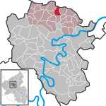
Kehrig in MYK
Kehrig in MYK

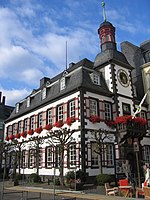
Kehrig is a municipality in the district of Mayen-Koblenz in Rhineland-Palatinate, Germany.

Excerpt from the Wikipedia article Kehrig (License: CC BY-SA 3.0, Authors, Images).

Kehrig
Polcher Straße, Vordereifel

Geographical coordinates (GPS) Address Nearby Places
placeShow on map

Wikipedia: KehrigContinue reading on Wikipedia

Geographical coordinates (GPS)

Latitude Longitude
N 50.282222222222 ° E 7.2277777777778 °
placeShow on map

Address

Polcher Straße
56729 Vordereifel
Rhineland-Palatinate, Germany
mapOpen on Google Maps

Kehrig in MYK
Kehrig in MYK
Share experience

Nearby Places

Kolliger Mühle
Kolliger Mühle

The Kolliger mill (German: Kolliger Mühle) is a watermill in Kollig, in the German Eifel region, 30 kilometres (19 mi) west of Koblenz and 13 kilometres (8.1 mi) from the river Moselle. The water wheel of the Kolliger Mühle is driven by the water of a small river, the Elzbach, also called the Elz. It is one of a great number of watermills in the Eifel region. Other watermills in the neighbourhood are the Gehringer Mühle and the Ölmühle. The oldest part of the mill probably dates from the 17th century. In the course of the centuries restorations have taken place but always bearing in mind the historic aspect of the place. There are four buildings on the site of the Kolliger mill: the Wirtschaftsgebäude with the central heating installation and the water supply device, the residence (Wohnhaus) with the water wheel, a former hen house and a former pigsty. The hen house and the pigsty have been renovated and made fit to live in. The pigsty is now the home of the owners and the former hen house is used as guesthouse (Gästehaus). The walls of the buildings are half-timbered with slate between the timbers. The roofs too are covered with slate. Between the houses is an inner courtyard paved with cobblestones and with a fountain in the middle. There is a small chapel at the entrance of the grounds. A branch of the famous historic pilgrim route to Santiago de Compostela (the Way of Saint James) runs along the Kolliger mill. Here, pilgrims can find a shelter for the night.

Katzenberg Hillfort
Katzenberg Hillfort

Katzenberg Hillfort (German: Spätrömische Höhenbefestigung Katzenberg or Römerwarte Mayen) is a Roman refuge fort near Mayen in Germany dating to the 4th century. The fortification on the Katzenberg hill was built around 300 AD after the Roman limes had been overrun and Germanic tribes had invaded and plundered the Roman Empire (the so-called Limesfall). The inhabitants of the Roman vicus, which was located on the site of the present-day town of Mayen, could escape to the fort in time of danger. At that time, town walls were built around the provincial capitals of Trier, Cologne and Mainz, as well as around smaller places like Koblenz or Andernach. The Katzenberg was the largest of about 60 Late Roman hillforts which were constructed in the Eifel and Hunsrück regions. They were used for about 70 years and then, after a 30-year pause, used again, in some cases until about 450 AD. On the uppermost crest of the hill is a small military outpost, the lower-lying open areas were probably used by the civilian population in the event of a threat. The fort covered an area of 1.2 hectares. The remains of the Late Roman hillfort were discovered around 1900 and excavated for the first time between 1907 and 1932. After a long pause, excavations were re-started in 1997 as part of the Volcano Park project. The finds were archaeologically investigated in Koblenz and the town of Mayen under the direction of the state office for cultural heritage. For the history of handicrafts the roofing finds were especially important. The roof slates found in the round towers were, surprisingly, shaped like scales, something which was rare in Roman times. In 2000, parts of the defensive wall and two round towers were reconstructed on original foundations of the walls. On the remains of the old military station on the hilltop, which had underfloor heating in the form of a hypocaust, a protective structure was built. All roofs were covered in slates in the form of scales and hexagons (for protection).