place

Belpre, Ohio

1789 establishments in the Northwest TerritoryBelpre, OhioCities in OhioCities in Washington County, OhioOhio populated places on the Ohio River
Populated places established in 1789Use mdy dates from April 2019
Capt. Jonathan Stone House

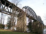
Belpre (historically spelled Belpré; pronounced BEL-pree) is a city in Washington County, Ohio, United States, along the Ohio River across from Parkersburg, West Virginia. The population was 6,728 at the 2020 census. Its name derives from "Belle Prairie" (French for "beautiful meadow"), the name given to the valley by French trappers prior to the first American settlement at the site.Belpre was the second settlement founded in the Northwest Territory after Marietta. The city is home to the first library established in the Territory. Its public school hired the first female schoolteacher in Ohio. Part of the Marietta micropolitan area, the city is located about 14 miles (22 km) downriver from Marietta. In 1870, the Baltimore and Ohio Railroad completed the Parkersburg Bridge (CSX) across the river; at 7,140 feet (2,180 m), it was reportedly the longest in the world.

Excerpt from the Wikipedia article Belpre, Ohio (License: CC BY-SA 3.0, Authors, Images).

Belpre, Ohio
Boulevard Drive,

Geographical coordinates (GPS) Address Nearby Places
placeShow on map

Wikipedia: Belpre, OhioContinue reading on Wikipedia

Geographical coordinates (GPS)

Latitude Longitude
N 39.280277777778 ° E -81.585 °
placeShow on map

Address

Boulevard Drive 1409
45714
Ohio, United States
mapOpen on Google Maps

Capt. Jonathan Stone House
Share experience

Nearby Places

Captain Jonathan Stone House

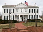
The Captain Jonathan Stone House is a historic residence in the city of Belpre, Ohio, United States. Built just ten years after Belpre's 1789 establishment on the north bank of the Ohio River, it is the oldest existing building in the city.Born in 1751, Jonathan Stone joined the Continental Army early in the American Revolutionary War. After the Treaty of Paris, he moved to the Belpre vicinity. He and his family built a fortification on their land during a war with local Native Americans in the early 1790s; it was known as "Stone's Fort." As the Belpre region developed, Stone became a leading member of the area's society; he was elected treasurer of Washington County, and he was one of the three commissioners chosen to survey lands for the future Ohio University in Athens to the west.Stone's house in Belpre is a two-story structure; except for a small wing on the rear northwestern corner, it is a rectangular building. The entire structure rests on a foundation of sandstone, and it is covered by a metal roof. Among its owners since Stone have been Dr. Thomas and Janet Barrett. At some point after Stone's life, the house was moved to its present location at 612 Blennerhassett Avenue. In 1978, the Stone House was listed on the National Register of Historic Places because of its historically significant architecture; it was seen as historic because of its place as a rare surviving example of Ohio's earliest residential architecture. It is one of four Belpre locations on the Register, along with the Charles Rice Ames House, the Sixth Street Railroad Bridge, and Spencer's Landing.Capt. Jonathan's son, Colonel John Stone, was another occupant of the house. He was an abolitionist with a bounty on his head offered by defenders of slavery in the state of Virginia; he therefore did not cross the river to Parkersburg (in what is now West Virginia) for more than 20 years. He is known to have "spirited many escaped slaves northward toward Canada".

Farmer's Castle
Farmer's Castle

Farmer's Castle was a defensive fortification built opposite the mouth of the Little Kanawha River on the Ohio River by a group of pioneers from the Ohio Company of Associates. It was located about 15 miles downriver of Marietta, Ohio, the first European-American settlement in the Northwest Territory. The pioneers had surveyed the land during the winter of 1788-89, and moved from Marietta to their new farms in April 1789. They called their town Belle-prairie, or modern day Belpre, Ohio. Adjacent to the island later known as Blennerhasset Island, the settlers began construction of Farmer's Castle during January 1791 for protection during the Northwest Indian War. The work was commenced the first week in January, and was prosecuted with the utmost energy, as their lives, apparently, depended on its completion. As fast as the block houses were built, the families moved into them. They were thirteen in number, arranged in two rows, with a wide street between, as shown in the engraving. The basement story was in general twenty feet square, and the upper about twenty-two feet, thus projecting over the lower one, and forming a defense from which to protect the doors and windows below, in an attack. They were built of round logs a foot in diameter, and the interstices nicely chinked and pointed with mortar. The doors and window shutters were made of thick oak planks, or puncheons, and secured with stout bars of wood on the inside. The larger timbers were hauled with ox-teams, of which they had several yokes, while the lighter for the roofs, gates, &c, were dragged along on hand sleds, with ropes, by the men. The drawing was much facilitated by a few inches of snow, which covered the ground. The pickets were made of quartered oak timber, growing on the plain back of the garrison, formed from trees about a foot in diameter, fourteen feet in length, and set four feet deep in the ground, leaving them ten feet high, over which no enemy could mount without a ladder. The smooth side was set outward, and the palisades strengthened and kept in their places by stout ribbons, or wall pieces, pinned to them with inch treenails on the inside. The spaces between the houses were filled up with pickets, and occupied three or four times the width of the houses, forming a continuous wall, or inclosure, about eighty rods in length and six rods wide. The palisades on the river side filled the whole space, and projected over the edge of the bank, leaning on rails and posts set to support them. They were sloped in this manner for the admission of air during the heat of summer.

Memorial Bridge (Parkersburg, West Virginia)

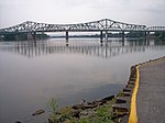
The Memorial Bridge, locally known as the toll bridge, crosses the Ohio River connecting Belpre, Ohio and Parkersburg, West Virginia. The bridge is an alternate route to access U.S. Route 50 in Ohio from central Parkersburg. While some internal WVDOT documents refer to the bridge as West Virginia Route 140, the number is not signed nor shown on state-issued maps.The bridge was completed c. 1954, and is of a steel through truss design, a combination of two camelback-Warren through trusses, and a 3-span cantilevered Warren through truss. It accommodates two lanes of traffic, one in either direction. This bridge used to have a toll for passenger cars of $0.50; travelers also used to purchase tickets to reduce the toll from $0.50 to $0.40 per trip when $2.00 worth was purchased. There were no automatic lanes and E-ZPass was not accepted. As part of the rehabilitation work on the bridge in 2022–23, the toll equipment has been replaced with an electronic tolling gantry that will accept E-ZPass or MovPass, a sticker transponder valid at the Memorial Bridge only. As of August 18, 2022, the bridge has been closed to all traffic indefinitely while a project to make improvements to the bridge is underway. Previously the bridge was reduced to one way traffic, but many vehicles were violating this by going around barriers which prompted the bridge partners to close it for safety of workers. As of August 31, 2023, the bridge has been reopened to all traffic.