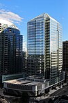
Fort Corcoran

Fort Corcoran was a wood-and-earthwork fortification constructed by the Union Army in northern Virginia as part of the defenses of Washington, D.C. during the American Civil War. Built in 1861, shortly after the occupation of Arlington, Virginia by Union forces, it protected the southern end of the Aqueduct Bridge and overlooked the Potomac River and Theodore Roosevelt Island, known as Mason's Island. The fort was named after Colonel Michael Corcoran, commander of the U.S. Fighting 69th Infantry, Irish Brigade 69th New York Volunteer Regiment, one of the units that constructed the fort. Fort Corcoran was home to the Union Army Balloon Corps and the headquarters of the defenses of Washington south of the Potomac River, and served throughout the war before being dismantled in 1866. Today, no trace of the fort remains, although the Arlington County government has erected a historical marker at its site.
Excerpt from the Wikipedia article Fort Corcoran (License: CC BY-SA 3.0, Authors, Images).Fort Corcoran
Key Boulevard, Arlington Rosslyn
Geographical coordinates (GPS) Address Nearby Places Show on map
Geographical coordinates (GPS)
| Latitude | Longitude |
|---|---|
| N 38.896222222222 ° | E -77.076583333333 ° |
Address
Key Boulevard
Key Boulevard
22209 Arlington, Rosslyn
Virginia, United States
Open on Google Maps


