Augsburg-Hammerschmiede
Districts of Augsburg

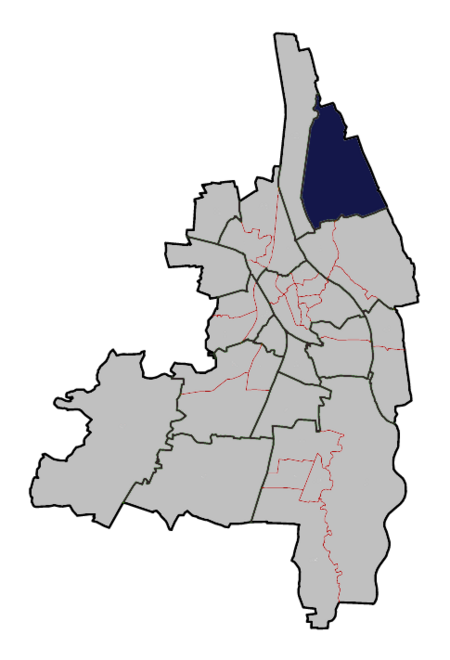
Augsburg-Hammerschmiede is one of the seventeen (17th) highest-level civic divisions, or planning districts, (German: Planungsräume) of Augsburg, Bavaria, Germany. As of January 1, 2006, it is estimated to have a population of 6,574. It is coterminous with the identically named 29th ward, or Stadtbezirk, and has an area of 9.21 km² (3.56 mi²).
Excerpt from the Wikipedia article Augsburg-Hammerschmiede (License: CC BY-SA 3.0, Authors, Images).Augsburg-Hammerschmiede
Apfelweg, Augsburg Hammerschmiede
Geographical coordinates (GPS) Address Nearby Places Show on map
Geographical coordinates (GPS)
| Latitude | Longitude |
|---|---|
| N 48.4 ° | E 10.911 ° |
Address
Apfelweg 6
86169 Augsburg, Hammerschmiede
Bavaria, Germany
Open on Google Maps


