place

Valley View, Ohio

Cleveland metropolitan areaUse mdy dates from July 2023Villages in Cuyahoga County, OhioVillages in Ohio
WILSON'S MILL, FORMERLY KNOWN AS ALEXANDER'S MILL, ON THE OHIO ERIE CANAL SOUTH OF ALEXANDER ROAD NEAR VALLEY VIEW... NARA 558001

Valley View is a village in Cuyahoga County, Ohio, United States. The population was 1,897 at the 2020 census. A suburb of Cleveland, it is a part of the Cleveland metropolitan area. Valley View's name refers to the Cuyahoga River valley, and the town includes part of the Cuyahoga Valley National Park and the Ohio and Erie Canal. It is home to the Valley View Bridge that is on Interstate 480 and crosses the Cuyahoga River.

Excerpt from the Wikipedia article Valley View, Ohio (License: CC BY-SA 3.0, Authors, Images).

Valley View, Ohio
Stone Road,

Geographical coordinates (GPS) Address Nearby Places
placeShow on map

Wikipedia: Valley View, OhioContinue reading on Wikipedia

Geographical coordinates (GPS)

Latitude Longitude
N 41.385277777778 ° E -81.617777777778 °
placeShow on map

Address

Stone Road 9584
44125
Ohio, United States
mapOpen on Google Maps

WILSON'S MILL, FORMERLY KNOWN AS ALEXANDER'S MILL, ON THE OHIO ERIE CANAL SOUTH OF ALEXANDER ROAD NEAR VALLEY VIEW... NARA 558001
Share experience

Nearby Places

Independence Slab
Independence Slab

The Independence Slab originally was a series of petroglyphs carved in an outcropping of native silicious Berea sandstone located in the city of Independence, Cuyahoga County, Ohio. It was discovered by area quarry workers in the mid-1800s who were quarrying building materials for a nearby church. The quarrymen are thought to have likely damaged large portions of the petroglyphs before realizing what they uncovered. A portion of the slab measuring 4 by 7 feet (1.2 by 2.1 m) was hand quarried and placed in the rear exterior wall of the Independence Presbyterian Church, sometime during 1854, where it has remained to this day. The surviving portions of the slab are thought to depict images of animal footprints, such as elk, and a crayfish. and the petroglyphs are believed to be part of the Whittlesey period (1000-1650 AD). The Independence Slab is unusual, not only for the unorthodox way it was found and preserved, but also because petroglyphs themselves are rarely found in the Northeast Ohio area. Most Ohio petroglyphs have been found exposed to the elements, but the Independence Slab was noted to have been buried under a layer of soil prior to its discovery.Today, the Independence Slab is still embedded in the walls of the Independence Presbyterian Church which is located near the Independence Public Square on Brecksville Road. The church was nominated to the National Register of Historic Places in the 1970s and mentioned the existence of the petroglyphs in its nomination documentation.

Independence Presbyterian Church

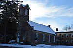
Independence Presbyterian Church is a historic church in the city of Independence, Ohio, United States. Constructed in the 1850s, the stone church building was originally home to a congregation heavily dependent on the local mining economy, but since the 1920s it has again been associated with an active congregation. It was named a historic site in the 1970s. Independence Presbyterian is largely a stone building; both the foundation and the walls are stone, and the roof is slate. The structure is that of a gabled rectangle with a square tower at the front, in which is placed the main entrance. The top of the tower includes a belfry with louvering. The overall design is simple with comparatively little ornamentation, although a significant counterexample is the building's back wall, in which was placed a prominent petroglyph known as the Independence Slab.Local Presbyterians were organized into a congregation in 1837, but nearly two decades passed before the building was built; it was constructed in 1855 according to a design produced by Jacob Merkle. The local economy at the time was heavily dependent on nearby stone quarries, and the congregation was no different: when the quarries closed in 1905, the congregation was also disorganized. After twenty years of vacancy, the building became home to another Presbyterian congregation in 1925. Growth forced the building's replacement in the 1960s, and a new structure was finished on an adjacent property in 1963. Since that time, the old building has generally been used only for special events. The congregation remains an active part of the Western Reserve Presbytery of the Presbyterian Church (USA).In 1977, the old church was listed on the National Register of Historic Places, qualifying because of its historically significant architecture. It is one of five National Register-listed locations in Independence, along with the Fuller-Bramley House, the Packard-Doubler House, the South Park Site, and the William Tricker Inc. Historic District.