place

Park Layne, Ohio

Census-designated places in Clark County, Ohio
OHMap doton Park Layne

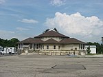
Park Layne is a census-designated place (CDP) in Clark County, Ohio, United States. The population of the CDP was 4,248 at the 2020 census. It is part of the Springfield, Ohio Metropolitan Statistical Area. On May 24, 2017, an EF1 tornado touched down and caused damage to several businesses in the community.

Excerpt from the Wikipedia article Park Layne, Ohio (License: CC BY-SA 3.0, Authors, Images).

Park Layne, Ohio
West Carpenter Drive,

Geographical coordinates (GPS) Address Nearby Places
placeShow on map

Wikipedia: Park Layne, OhioContinue reading on Wikipedia

Geographical coordinates (GPS)

Latitude Longitude
N 39.886666666667 ° E -84.039444444444 °
placeShow on map

Address

West Carpenter Drive 495
45344
Ohio, United States
mapOpen on Google Maps

OHMap doton Park Layne
Share experience

Nearby Places

William Baumgardner Farm

The William Baumgardner Farm is a historic farmstead located near New Carlisle in Miami County, Ohio, United States. Constructed in 1857, the site remains typical of period farmsteads, and it has been named a historic site. William Baumgardner was one of Miami County's wealthiest farmers, and his landholdings were among the county's widest. He was able to pay for the construction of the entire complex in 1857, including the house, a separate summer kitchen, one large barn for animal shelter and hay storage, a granary, a spring house, a barn for seed storage, and a carriage house. Comparatively few changes have been made to the complex, which accordingly remains among the region's best-preserved farmsteads from the middle of the nineteenth century.Baumgardner's house is a two-story brick building placed on a stone foundation. Chimneys sit on either end of the roofline, which is created by gables on either side. Both the side and the facade comprise three bays, with the middle bay of the facade occupied by a portico-sheltered door on the first story and a secondary door opening onto the portico roof on the second story. A single-story extension sits at the rear, causing the general floor plan to have the shape of the letter "T". Inside, the original features are still present. Buildings throughout the complex possess decorative features such as cupolas and miniature gables, giving the farmstead an appearance of architectural harmony. None of the buildings in the farmstead have been moved since their construction.In early 1978, the Baumgardner Farm was listed on the National Register of Historic Places, qualifying both because of its place in local history and because of its historically significant architecture. The complex comprises six contributing properties, all of which are buildings. The complex is one of three National Register-listed locations near New Carlisle, along with Olive Branch High School and Ollie's Tavern in Clark County to the east.

Arnold Homestead
Arnold Homestead

The Arnold Homestead is a historic homestead in the city of Huber Heights, a suburb of Dayton, Ohio, United States. Formed at the turn of the nineteenth century, it centers on an 1830s farmhouse that was built for an immigrant family from Virginia. A native of present-day West Virginia, Daniel Arnold sold his farm and brought his wife Catherine and five children to settle in present-day Huber Heights in the early nineteenth century. Members of the Dunkard Brethren Church, they typified the German immigrant church's gradual movement westward as it gradually integrated with American society. After renting land over their first winter, Arnold bought the present farmstead from Henry Harshberger and occupied it for the remnant of his life. The family used a log cabin during their first years at the site before significantly improving their lives by constructing the present house in 1835.Built of brick, the farmhouse rests on a stone foundation, is topped by an asphalt roof, and features additional elements of wood and asphalt. The basic plan is a simple two-story rectangle, wider than its length, with windowless ends that rise to chimney-topped gables. An extension, most of the width of the house, is attached to the rear, while a porch occupies the ell. Three windows pierce the second story on the facade, while the main entrance sits at the center of the first story between one window on either side. A small porch with a shed roof shelters the entrance. Besides the farmhouse, the complex includes a cemetery and six outbuildings, including the original log cabin and a bank barn.Today, the Arnold farmstead is the core of Carriage Hill MetroPark. The farmhouse is operated as a historic house museum, staffed by individuals costumed as nineteenth-century farmers, while other parts of the farmstead are operated for ancillary purposes. The complex was listed on the National Register of Historic Places in 1977, qualifying both because of its place in local history and because of Daniel Arnold's significance in the area's settlement. It is one of four Huber Heights locations on the Register, along with the Ausenbaugh-McElhenny House, the Taylorsville Canal Inn (demolished), and Lock Seventy on the Miami and Erie Canal.