place

GCHQ

1919 establishments in the United KingdomBritish intelligence agenciesComputer security organizationsCryptography organizationsForeign Office during World War II
Foreign relations of the United KingdomGCHQGovernment agencies established in 1919Headquarters in the United KingdomOrganisations based in CheltenhamOrganizations associated with Russian interference in the 2016 United States electionsSignals intelligence agenciesUse British English from August 2020
Aerial of GCHQ, Cheltenham, Gloucestershire, England 24May2017 arp

Government Communications Headquarters, commonly known as GCHQ, is an intelligence and security organisation responsible for providing signals intelligence (SIGINT) and information assurance (IA) to the government and armed forces of the United Kingdom. Primarily based at "The Doughnut" in the suburbs of Cheltenham, GCHQ is the responsibility of the country's Secretary of State for Foreign and Commonwealth Affairs (Foreign Secretary), but it is not a part of the Foreign Office and its Director ranks as a Permanent Secretary. GCHQ was originally established after the First World War as the Government Code and Cypher School (GC&CS) and was known under that name until 1946. During the Second World War it was located at Bletchley Park, where it was responsible for breaking the German Enigma codes. There are two main components of the GCHQ, the Composite Signals Organisation (CSO), which is responsible for gathering information, and the National Cyber Security Centre (NCSC), which is responsible for securing the UK's own communications. The Joint Technical Language Service (JTLS) is a small department and cross-government resource responsible for mainly technical language support and translation and interpreting services across government departments. It is co-located with GCHQ for administrative purposes. In 2013, GCHQ received considerable media attention when the former National Security Agency contractor Edward Snowden revealed that the agency was in the process of collecting all online and telephone data in the UK via the Tempora programme. Snowden's revelations began a spate of ongoing disclosures of global surveillance. The Guardian newspaper was forced to destroy computer hard drives with the files Snowden had given them because of the threats of a lawsuit under the Official Secrets Act.

Excerpt from the Wikipedia article GCHQ (License: CC BY-SA 3.0, Authors, Images).

Geographical coordinates (GPS)

Latitude Longitude
N 51.899444444444 ° E -2.1244444444444 °
placeShow on map

Address

Government Communications Headquarters (The Doughnut)

The Street
GL51 0EX , Fiddler's Green
England, United Kingdom
mapOpen on Google Maps

Website
gchq.gov.uk

linkVisit website

linkWikiData (Q220798)
linkOpenStreetMap (52434)

Aerial of GCHQ, Cheltenham, Gloucestershire, England 24May2017 arp
Share experience

Nearby Places

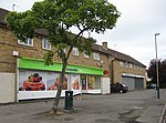
Benhall, Cheltenham

Benhall is a small district within the town of Cheltenham, Gloucestershire. It lies south-west of the town centre, just south of the A40, the main road to Gloucester, and north of the district of Up Hatherley. It falls mainly within the Anglican parish of St Mark. Much of the area consists of the Benhall (originally Benhall Farm) Estate, developed mainly in the late 1950s and early 1960s on land that had previously been farmland (mainly pasture), and takes its name from the farm that formerly stood there (at the site of the current Notgrove Close). The district is divided in two by a stream with steep banks, surrounded by a narrow area of grass and woodland. Many of the roads are named after villages in the surrounding countryside. "Robert Burns Avenue" was named after the Scottish poet, after complaints that he was not among the poets with roads named after them in the older St Mark's estate (Tennyson, Byron, Shakespeare, etc.), even though he had a personal link with Cheltenham (his sons retired to the town). St Mark's Church of England Junior School and Benhall Infants School, along with a playgroup, are located on Robert Burns Avenue in Benhall. The last census recorded the population of Benhall at 3260. The area has an active residents' association. In local government it forms part of the ward of Benhall and the Reddings. The population of this Ward in the 2011 Census was 5,071.There are 1,362 households within the Benhall district and an average unemployment rate of 1.7%.[1] Benhall is the location of 'The Doughnut', the nickname given to the headquarters of the Government Communications Headquarters (GCHQ), the British intelligence agency who specialise in signals intelligence and cryptography.