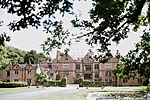
Henhull

Henhull is a former civil parish, now in the parishes of Burland and Acton and Nantwich, in the unitary authority area of Cheshire East and the ceremonial county of Cheshire, England, which lies to the north west of Nantwich. For administrative purposes, was is combined with adjacent civil parishes of Acton and Edleston to form a total area of 765 hectares (1890 acres). The parish was predominantly rural with scattered farms and houses and no large settlements. In 2019 a 1,100-house development called Kingsbourne was being built in the east of the parish as an extension to the town of Nantwich. Henhull civil parish also included the hamlets of Basin End, Bluestone, Welshmen's Green and part of Burford. Nearby villages include Acton and Rease Heath. According to the 2001 census, Henhull had a population of 71. At the 2011 Census the population remained less than 100. In 2017, there were 26 households in the civil parish.
Excerpt from the Wikipedia article Henhull (License: CC BY-SA 3.0, Authors, Images).Henhull
Chester Road,
Geographical coordinates (GPS) Address Nearby Places Show on map
Geographical coordinates (GPS)
| Latitude | Longitude |
|---|---|
| N 53.071 ° | E -2.54 ° |
Address
Chester Road
Chester Road
CW5 8LA , Burland and Acton
England, United Kingdom
Open on Google Maps


