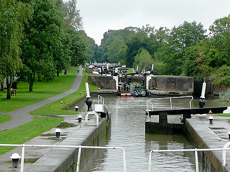
Warwickshire ring

The Warwickshire ring is a connected series of canals forming a circuit around the West Midlands area of England. The ring is formed from the Coventry Canal, the Oxford Canal, the Grand Union Canal, the Stratford-upon-Avon Canal and the Birmingham and Fazeley Canal. It is a popular route with tourists due to its circular route and mixture of urban and rural landscapes. The ring totals 106 miles and has 115 locks, although there are two alternative routes through the southern part of Birmingham - from Kingswood Junction, one route follows the Grand Union Canal to Salford Junction, where it joins the Birmingham and Fazeley Canal, and the other follows the Stratford Canal (north) and Worcester and Birmingham Canal to Gas Street Basin in central Birmingham. The latter route is slightly longer and has more locks, but many consider it to be more scenic and interesting.
Excerpt from the Wikipedia article Warwickshire ring (License: CC BY-SA 3.0, Authors, Images).Warwickshire ring
Huntingdon Close,
Geographical coordinates (GPS) Address Nearby Places Show on map
Geographical coordinates (GPS)
| Latitude | Longitude |
|---|---|
| N 52.6209 ° | E -1.7093 ° |
Address
Huntingdon Close
Huntingdon Close
B78 3XS , Kettlebrook
England, United Kingdom
Open on Google Maps


