Florianturm

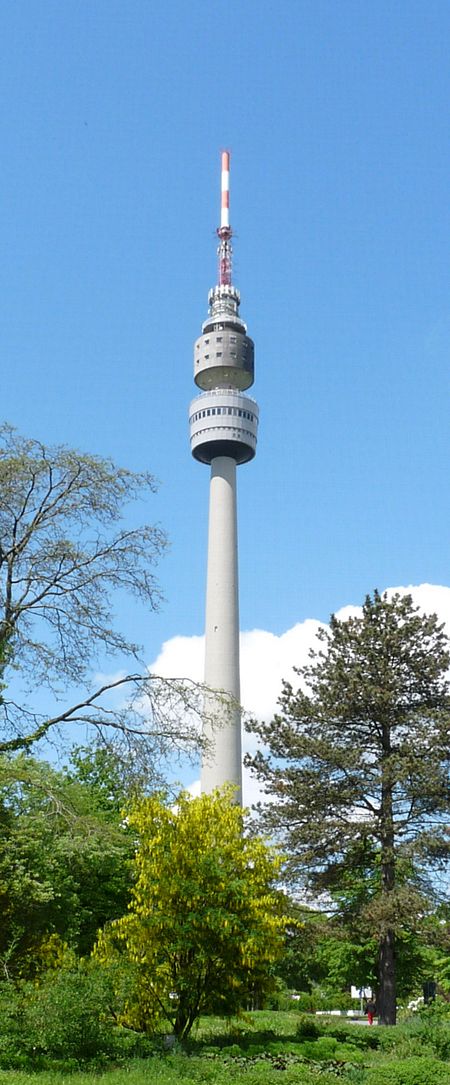
The Florianturm (Florian Tower, Florian for short) is a telecommunications tower and landmark of Dortmund (Germany). It is named after St. Florian, the patron saint of gardeners. The Florianturm is the TV tower of Dortmund and was built in 1959 as an attraction for a federal horticultural show with a height of 219.6 metres (720 ft). At the time it was briefly the highest freestanding structure in Germany. The tower was constructed similarly to a high concrete chimney. It consists of a reinforced concrete tube, which tapers off as it rises, reaching a height of 129.75 metres (425.7 ft). At 130.6 metres (428 ft) there is a building part with two floors. On the lower floor there are operation rooms and on the upper floor at 137.54 metres (451.2 ft) there is a revolving restaurant. At 141.88 metres (465.5 ft) and 144.7 metres (475 ft) there are two observation decks. On the upper observation deck there are installations and aerials of Deutsche Telekom. Since 1959 it has been used for transmitting television signals. On 7 September 2004, a Russian helicopter was used to replace the aerial. Since then, a 50-kilowatt transmitter has transmitted digital terrestrial television programmes for the Dortmund area. Since 7 September 2004, the Florianturm has a height of 208.56 metres (684.3 ft), making it the fourteenth highest structure in Germany. From 1996 to 1998, the tower was renovated and safety standards were brought up to date. In 2000, a catwalk for bungee jumping was opened on the upper platform. It was closed in 2003 after a fatal accident and was removed in July 2008.
Excerpt from the Wikipedia article Florianturm (License: CC BY-SA 3.0, Authors, Images).Florianturm
Florianstraße, Dortmund Innenstadt Ost
Geographical coordinates (GPS) Address Nearby Places Show on map
Geographical coordinates (GPS)
| Latitude | Longitude |
|---|---|
| N 51.496388888889 ° | E 7.4763888888889 ° |
Address
Florianstraße 2a
44139 Dortmund, Innenstadt Ost
North Rhine-Westphalia, Germany
Open on Google Maps


