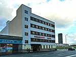
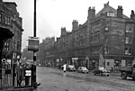
Bridgeton, Glasgow
Areas of GlasgowBridgeton–Calton–DalmarnockIrish diaspora in ScotlandRoad junctions in GlasgowUse British English from May 2015

Bridgeton (Scots: Brigtoun, Scottish Gaelic: Baile na Drochaid) is a district to the east of Glasgow city centre. Historically part of Lanarkshire, it is bounded by Glasgow Green to the west, Dalmarnock to the east and south, Calton to the north-west at Abercromby Street/London Road and Broad street to the north-east.
Excerpt from the Wikipedia article Bridgeton, Glasgow (License: CC BY-SA 3.0, Authors, Images).Bridgeton, Glasgow
Rimsdale Street, Glasgow Gallowgate
Geographical coordinates (GPS) Address Nearby Places Show on map
Geographical coordinates (GPS)
| Latitude | Longitude |
|---|---|
| N 55.85 ° | E -4.2218 ° |
Address
Rimsdale Street
G40 3DP Glasgow, Gallowgate
Scotland, United Kingdom
Open on Google Maps


