Kraków-Częstochowa Upland

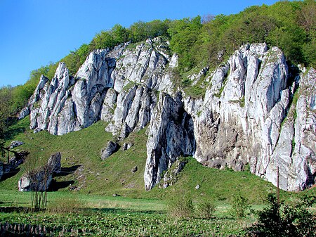
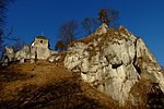
The Kraków-Częstochowa Upland, also known as the Polish Jurassic Highland or Polish Jura (Polish: Jura Krakowsko-Częstochowska), is part of the Jurassic System of south–central Poland, stretching between the cities of Kraków, Częstochowa and Wieluń. The Polish Jura borders the Lesser Polish Upland to the north and east, the foothills of the Western Carpathians to the south and Silesian Upland to the west. The Polish Jura consists of a hilly landscape with Jurassic limestone rocks, cliffs, valleys and vast limestone formations, featuring some 220 caves. The relief of the upland developed since the Paleogene, under climatic conditions changing considerably. Its main component is a peneplain, crowned by monadnocks, rocky masses that resisted erosion, generated as hard rock on Late Jurassic buildup surrounded by less resistant bedded limestone of the same age. The Polish Jura is visited by roughly 400,000 visitors a year. Part of it belongs to the Ojców National Park, the smallest of Poland's twenty national parks, ranking among the most attractive recreational areas of the country.
Excerpt from the Wikipedia article Kraków-Częstochowa Upland (License: CC BY-SA 3.0, Authors, Images).Kraków-Częstochowa Upland
gmina Skała
Geographical coordinates (GPS) Address Nearby Places Show on map
Geographical coordinates (GPS)
| Latitude | Longitude |
|---|---|
| N 50.206667 ° | E 19.829167 ° |
Address
32-047 gmina Skała
Lesser Poland Voivodeship, Poland
Open on Google Maps


