Mühlbachl
Cities and towns in Innsbruck-Land DistrictTyrol geography stubs

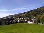
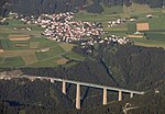
Mühlbachl was a municipality in the district Innsbruck-Land located 15 km south of Innsbruck. Mühlbachl extended from the southern slopes of Schönberg im Stubaital along Matreiwald to Steinach (to the aperture of the Navistal) and the Sill River flew through it. It had 1,349 inhabitants. On 1 January 2022 Mühlbachl and Pfons were merged into the municipality of Matrei am Brenner.A famous place of pilgrimage, Maria Waldrast, can be reached by hiking up the mountain Serles to the west. The Serles is 2,718 metres high.
Excerpt from the Wikipedia article Mühlbachl (License: CC BY-SA 3.0, Authors, Images).Mühlbachl
Mühlbachl,
Geographical coordinates (GPS) Address Nearby Places Show on map
Geographical coordinates (GPS)
| Latitude | Longitude |
|---|---|
| N 47.136111111111 ° | E 11.451944444444 ° |
Address
Mühlbachl
Mühlbachl
6143
Austria
Open on Google Maps


