Ide Hill

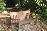
Ide Hill is a village within the civil parish of Sundridge with Ide Hill, in the Sevenoaks District of Kent, England. It stands on one of the highest points of the Greensand Ridge about three miles south-west of Sevenoaks. Its name first appears on record in 1250 as Edythehelle. It is an eponymic denoting 'Edith's hill', from the Old English hyll 'hill'. The village lies within the Kent Downs Area of Outstanding Natural Beauty. The church is relatively modern. The village had an Anglican chapel in 1806, built by Beilby Porteus, Bishop of London, who lived in nearby Sundridge; St Mary's church was built in 1865 and "has the distinction of being the highest church in Kent" at 216 metres (709 ft) above sea level, as well as boasting a beautiful lychgate, crafted by local builder Cecil 'Dusty' Boakes. There are several old buildings round the sloping village green, including the 18th-century Cock Inn and the Ide Hill Village School, built in 1856 it is the second home of the school which unusually for a church school predates the church building as the school was formed in 1809. Ide Hill Football Club, who have teams in the Kent County League, the Sevenoaks & District League and the Crowborough & District Junior League, play their home games on the Ide Hill Recreation Ground (behind the Cock Inn). As per the church, the football pitch "has the distinction of being the highest in Kent". Two of Kent's places of interest are near Ide Hill: Bough Beech Reservoir and Emmetts Garden. Bough Beech Reservoir was completed in 1969. A large area round it is leased to the Kent Trust for Nature Conservation as a nature reserve. Emmetts Garden is in the care of the National Trust. It was laid out in the late 19th century. There is a stone seat near the village church to commemorate Octavia Hill, one of the Trust's founders. In his 1933 memoir Down and Out in Paris and London George Orwell reports that Ide Hill was notorious for being the worst “spike” (a casual ward or homeless shelter) in all of England. Although in a footnote he confesses to finding it 'not so bad'.
Excerpt from the Wikipedia article Ide Hill (License: CC BY-SA 3.0, Authors, Images).Ide Hill
Geißbichlweg,
Geographical coordinates (GPS) Address Nearby Places Show on map
Geographical coordinates (GPS)
| Latitude | Longitude |
|---|---|
| N 51.247 ° | E 0.129 ° |
Address
Geißbichlweg 1
82396
Bayern, Deutschland
Open on Google Maps


