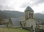
Col de Peyresourde
Climbs in cycle racing in FranceMountain passes of Haute-GaronneMountain passes of Hautes-PyrénéesMountain passes of the Pyrenees

The Col de Peyresourde (Occitan: Còth de Pèira Sorda) (elevation 1,569 m (5,148 ft)) is a mountain pass in the central Pyrenees on the border of the department of Haute-Garonne and Hautes-Pyrénées in France. It is situated on the D618 road between Bagnères-de-Luchon and Arreau.
Excerpt from the Wikipedia article Col de Peyresourde (License: CC BY-SA 3.0, Authors, Images).Col de Peyresourde
Route du Col de Peyresourde, Bagnères-de-Bigorre
Geographical coordinates (GPS) Address Nearby Places Show on map
Geographical coordinates (GPS)
| Latitude | Longitude |
|---|---|
| N 42.802222222222 ° | E 0.46277777777778 ° |
Address
Route du Col de Peyresourde
Route du Col de Peyresourde
65240 Bagnères-de-Bigorre
Occitania, France
Open on Google Maps


