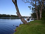
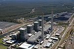
Cooranbong, New South Wales
1826 establishments in AustraliaSuburbs of Lake MacquarieTowns in New South WalesTowns in the Hunter RegionUse Australian English from March 2017
Cooranbong ( KOR-ən-BONG;) is a town in a suburb of the City of Lake Macquarie, Greater Newcastle in New South Wales, Australia, west of the town of Morisset off the M1 Pacific Motorway. Cooranbong is surrounded by the Watagans National Park. The town's name is derived from the Aboriginal word "Kour-an-bong", meaning "rocky bottom creek" or "water over rocks". There is a particularly large Seventh-day Adventist presence in Cooranbong. As of the 2021 census, 23.5% of the suburb is Seventh-day Adventist, which is higher than every other religious denomination besides "no religion".
Excerpt from the Wikipedia article Cooranbong, New South Wales (License: CC BY-SA 3.0, Authors).Cooranbong, New South Wales
Currawong Avenue, Lake Macquarie City Council
Geographical coordinates (GPS) Address Nearby Places Show on map
Geographical coordinates (GPS)
| Latitude | Longitude |
|---|---|
| N -33.074 ° | E 151.451 ° |
Address
Currawong Avenue
Currawong Avenue
2265 Lake Macquarie City Council, Cooranbong
New South Wales, Australia
Open on Google Maps


