place

Dr. Jose Rizal Park (Seattle)

Beacon Hill, SeattleKing County, Washington geography stubsMemorials to José RizalParks in Seattle
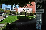
Seattle Skyline from Rizal Park

Dr. Jose Rizal Park is a 9.6 acre (39,000 m²) park on the west slope of Beacon Hill in Seattle, Washington. The land, condemned by the city in 1917 for engineering purposes, was acquired by the Parks Department in 1971, and the park was dedicated eight years later. The park is named after José Rizal, national hero of the Philippines. Rizal Park is bounded on the west by Interstate 5, on the north by Interstate 90, on the east by 12th Avenue S., and on the south by S. Judkins Street and the Jungle. The park consists of a grassy upper area with shelter and picnic tables, a wooded hillside, and an off-leash dog park at the foot of the hill.

Excerpt from the Wikipedia article Dr. Jose Rizal Park (Seattle) (License: CC BY-SA 3.0, Authors, Images).

Dr. Jose Rizal Park (Seattle)
Mountains-to-Sound Trail, Seattle Yesler Terrace

Geographical coordinates (GPS) Address Nearby Places
placeShow on map

Wikipedia: Dr. Jose Rizal Park (Seattle)Continue reading on Wikipedia

Geographical coordinates (GPS)

Latitude Longitude
N 47.593083333333 ° E -122.31858333333 °
placeShow on map

Address

Jose Rizal Dog Park

Mountains-to-Sound Trail
98104 Seattle, Yesler Terrace
Washington, United States
mapOpen on Google Maps

Seattle Skyline from Rizal Park
Share experience

Nearby Places

Sound Transit
Sound Transit

Sound Transit (ST), officially the Central Puget Sound Regional Transit Authority, is a public transit agency serving the Seattle metropolitan area in the U.S. state of Washington. It operates the Link light rail system in Seattle and Tacoma, regional Sounder commuter rail, and Sound Transit Express bus service. The agency also coordinates the regional ORCA fare card system, which is also used by local transit operators. In 2017, Sound Transit services carried a total of 47 million passengers and averaged 157,000 riders on weekdays.Sound Transit was created in 1993 by King, Pierce and Snohomish counties to build a regional rapid transit system. After an unsuccessful proposal in 1995, the agency's plan for regional light rail, commuter rail, and express bus service, named "Sound Move", was approved in November 1996. ST began operating its express bus service in September 1999, taking over existing routes from local transit agencies. The region's first commuter rail line, between Tacoma and Seattle, started in December 2000; the agency's first light rail line, Tacoma Link (now Line T), began service in August 2003. Light rail service in Seattle on Central Link (now Line 1) began in 2009, and is the largest part of the Sound Transit system in terms of ridership. Union Station in Seattle has served as the agency's headquarters since its renovation in 1999.Sound Transit is independent of local transit agencies and is governed by an eighteen-member Board of Directors made up of elected officials from member jurisdictions and the Secretary of Transportation. It is funded by local sales taxes, property taxes, and motor vehicle excise taxes, levied within its taxing district in portions of King, Pierce and Snohomish counties. The agency has passed three major ballot measures to fund system expansion: Sound Move (1996), Sound Transit 2 (2008) and Sound Transit 3 (2016). Planning and construction of new light rail lines is scheduled to continue until 2041 under the Sound Transit 3 plan, which would expand the network to 116 miles (187 km) and 70 stations.