place

Harmaja

AC with 0 elementsBuildings and structures in HelsinkiCommons category link is locally definedEuropean lighthouse stubsFinland geography stubs
Finnish building and structure stubsIslands of HelsinkiLighthouses completed in 1883Lighthouses completed in 1900Lighthouses in FinlandOlympic sailing venuesSummer Olympic venue stubsVenues of the 1952 Summer Olympics
Gråhara Harmaja
Gråhara Harmaja

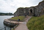
Harmaja (Swedish: Gråhara) is an island and a lighthouse outside Helsinki, south of the Suomenlinna sea fortress. The island has been functioning as a landmark since the 16th century. A landmark structure was built on the island in the 18th century and a light house in 1883. The first lighthouse was only 7.3 m high and it soon proved to be too low. In 1900 the height was doubled by creating a rectangular brick building on a granite base. A large foghorn alerted ships in fog and in bad visibility. Harmaja received the world's first directed and undirected radio beacon in 1936. The lighthouse is fully automated today. There is also a pilot station on the island. During the 1952 Summer Olympics this was the center of the Olympic sailing event.

Excerpt from the Wikipedia article Harmaja (License: CC BY-SA 3.0, Authors, Images).

Harmaja
Näköalatasanne, Helsinki Suomenlinna (Southern major district)

Geographical coordinates (GPS) Address External links Nearby Places
placeShow on map

Wikipedia: HarmajaContinue reading on Wikipedia

Geographical coordinates (GPS)

Latitude Longitude
N 60.104444444444 ° E 24.974444444444 °
placeShow on map

Address

Harmajan majakka

Näköalatasanne
00190 Helsinki, Suomenlinna (Southern major district)
Finland
mapOpen on Google Maps

linkWikiData (Q3127504)
linkOpenStreetMap (340022906)

Gråhara Harmaja
Gråhara Harmaja
Share experience

Nearby Places

Kuninkaanportti
Kuninkaanportti

Kuninkaanportti or Kungsporten (Finnish and Swedish respectively for "the king's gate") is the principal entrance to the fortress Suomenlinna (Swedish: Sveaborg) outside Helsinki. It is on the southernmost island of Suomenlinna, in front of the Kustaanmiekka strait, and is considered the main symbol of Suomenlinna. The gate was constructed from 1753 to 1754 at the place where King Adolf Frederick of Sweden anchored his ship when he was coming to inspect the construction of the fortress. The name "the king's gate" comes from this. The gate is a typical fortress gate with cannon openings. There are wide stairs leading to the gate, but in front of the gate is a drawbridge and a wide pit at both sides, to hinder climbing into the fortress. The gate was featured in the 1000 Finnish mark note in the last series, from 1986 to 2001. As a decoration, the sides of the gate feature four stone tablets which were written by the designer of the fortress, Augustin Ehrensvärd, in Swedish: Här har konung Fredrik låtit läggs den första sten år 1748 ("Here laid King Frederick the first stone in the year 1748") Och konung Gustaf har lagt den sista sten år .. ("And here laid King Gustav the last stone in the year", the year is left unwritten, because Gustav III never arrived to lay the last stone) Sveaborg som rörer hafvet på den ena sidan och stranden på den andra, giver den kloke herravälde på både haf och land ("Sveaborg (Suomenlinna), which touches the sea on one side and the shore on the other, gives the wise control both on sea and on land.") Ifrån ödemarker äro desse Vargskiärsholmar ombytte till ett Sveaborg. Eftervard, stå här på egen botn, och lita icke på främmande hielp. ("From desolate lands, these Wolf Islands have been transformed into a Sveaborg (Suomenlinna). Progeny, stand here on your own foundation, and do not rely on foreign help.")

Suomenlinna
Suomenlinna

Suomenlinna (Finnish: [ˈsuo̯menˌlinːɑ]; until 1918 Viapori, Finnish: [ˈviaˌpori]), or Sveaborg (Swedish: [ˈsvɛːɑˈborj]), is an inhabited sea fortress built on eight islands about 4 km southeast of the city center of Helsinki, the capital of Finland. Suomenlinna is popular with tourists and locals who enjoy it as a picturesque picnic site. Originally named Sveaborg (Castle of the Swedes), or Viapori as referred to by Finnish-speaking Finns, it was renamed in Finnish to Suomenlinna (Castle of Finland) in 1918 for patriotic and nationalistic reasons, though it is still known by its original name in Sweden and by Swedish-speaking Finns. The Swedish crown commenced the construction of the fortress in 1748 as protection against Russian expansionism. The general responsibility for the fortification work was given to Augustin Ehrensvärd. The original plan of the bastion fortress was strongly influenced by the ideas of Vauban, the foremost military engineer of the time, and the principles of the star fort style of fortification, albeit adapted to a group of rocky islands. Famous for these bastion fortifications, Suomenlinna became a UNESCO World Heritage Site in 1991.During the Finnish War, Sweden surrendered the fortress to Russia on 3 May 1808, paving the way for the occupation of Finland by Russian forces in 1809, and the eventual cession of Finland to Russia at the conclusion of the war. Russia held the fortress until Finnish independence in 1918. Finland then managed Suomenlinna through the Defense Department until turning most of it over to civilian control in 1973.

Vallisaari
Vallisaari

Vallisaari (Swedish: Skanslandet) is an island in Helsinki, Finland. It is located between Suomenlinna and Santahamina. The island has some ponds, and it was first known for hundreds of years as a place where sailors could take fresh water. Some fortifications were built on the island, but while neighbouring Suomenlinna became the main sea fort for Helsinki, Vallisaari was a supply point where cattle was grazing and firewood was collected.Sweden and Russia were at war in 1808 and the Russians besieged Suomenlinna, they used Vallisaari as their base. When ruling the Grand Duchy of Finland Russians began developing fortifications in Vallisaari. It was part of Krepost Sveaborg. After Finland gained its independence in 1917, weaponry of the Defence Forces was stored in Vallisaari until the 21st century. Ordnance, torpedoes, and mines were loaded and maintained; weather observations were made; and gas masks were repaired. There was some civilian population, too, which lead quite rural life farming on the island The civilian population was largest in the 1950s, when the island had even its own primary school.The Finnish Defence Forces gave up the islands in 2008 and Vallisaari was opened as tourism destination in 2016. Before the island was opened, vegetation has been cleared, stairs and railings build and info signs and dry toilets added. The plumbing is not in such a shape that it could be used any more.Now Vallisaari is the most diverse nature destination in the metropolitan area. The Russian history of the island is reflected in the plants, some of which were brought to the island with animal fodder. Military activities have kept the embankments and the meadows between fortifications open, thereby enriching the diversity of nature. Several rare insects and bats fly on the island.