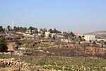
Alon Shvut
1970 establishments in the Israeli Military GovernorateCommunity settlementsGush Etzion Regional CouncilIsraeli settlements in the West BankPopulated places established in 1970 ... and 2 more
Religious Israeli settlementsWikipedia extended-confirmed-protected pages

Alon Shvut (Hebrew: אַלּוֹן שְׁבוּת) is an Israeli settlement in the West Bank, established in June 1970 over lands confiscated from the nearby Palestinian town of Khirbet Beit Zakariyyah. It is part of the Etzion bloc of the West Bank, administered by the Gush Etzion Regional Council, and neighbors the Jewish settlements of Kfar Etzion, Rosh Tzurim, Neve Daniel, Elazar, Bat Ayin, Migdal Oz, and Efrat. In 2021, its population was 3,061. The international community considers Israeli settlements in the West Bank illegal under international law, but the Israeli government disputes this.
Excerpt from the Wikipedia article Alon Shvut (License: CC BY-SA 3.0, Authors, Images).Alon Shvut
HaTamar,
Geographical coordinates (GPS) Address Nearby Places Show on map
Geographical coordinates (GPS)
| Latitude | Longitude |
|---|---|
| N 31.654722222222 ° | E 35.127777777778 ° |
Address
התמר
HaTamar
Judea and Samaria, Palestinian Territories
Open on Google Maps


