place

Upstate South Carolina

Geography of Abbeville County, South CarolinaGeography of Anderson County, South CarolinaGeography of AppalachiaGeography of Cherokee County, South CarolinaGeography of Greenville County, South Carolina
Geography of Greenwood County, South CarolinaGeography of Laurens County, South CarolinaGeography of Oconee County, South CarolinaGeography of Pickens County, South CarolinaGeography of Spartanburg County, South CarolinaGeography of Union County, South CarolinaPages with non-numeric formatnum argumentsRegions of South CarolinaUpstate South CarolinaUse American English from September 2019Use mdy dates from September 2019
Greenville Spartanburg Anderson CSA

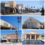
The Upstate, historically known as the Upcountry, is a region of the U.S. state of South Carolina, comprising the northwesternmost area of the state. Although loosely defined among locals, the general definition includes the 10 counties of the commerce-rich I-85 corridor in the northwest corner of South Carolina. This definition coincided with the Greenville-Spartanburg-Anderson, SC Combined Statistical Area, as first defined by the Office of Management and Budget (OMB) in 2015. In 2023, the OMB issued its most updated definition of the CSA that coincides again with the 10-county region.The region's population was 1,487,610 as of 2020. Situated between Atlanta and Charlotte, the Upstate is the geographical center of the Charlanta megaregion. After BMW's initial investment, foreign companies, including others from Germany, have a substantial presence in the Upstate; several large corporations have established regional, national, or continental headquarters in the area. Greenville is the largest city in the region with a population of 72,227 and an urban-area population of 387,271, and it is the base of most commercial activity. Spartanburg and Anderson are next in population.

Excerpt from the Wikipedia article Upstate South Carolina (License: CC BY-SA 3.0, Authors, Images).

Upstate South Carolina
Sweet Apple Court,

Geographical coordinates (GPS) Address Nearby Places
placeShow on map

Wikipedia: Upstate South CarolinaContinue reading on Wikipedia

Geographical coordinates (GPS)

Latitude Longitude
N 34.716666666667 ° E -82.183333333333 °
placeShow on map

Address

Sweet Apple Court

Sweet Apple Court
29644
South Carolina, United States
mapOpen on Google Maps

Greenville Spartanburg Anderson CSA
Share experience

Nearby Places

Fountain Inn High School

The Fountain Inn High School was a building that formerly served as a high school, located in Fountain Inn, South Carolina. It was designed by the Greenville, South Carolina based architectural firm Beacham and LeGrand and built in 1939. An example of New Deal-era design in the Moderne style, its construction was undertaken using grants by the Public Works Administration program.The L-shaped two-story building on a basement has exterior brick walls set on concrete footings. The original 800-seat auditorium has hardwood flooring on the main floor as well as the stage floor. The ceiling features period art deco style patterned panels and lights. The sides of the auditorium are covered in wood panels.The building served as the high school for the town for only 17 years, until the construction of Hillcrest High School was completed just outside the town. In 1957 when the new high school opened, the building became Fountain Inn Elementary School until a new school was constructed in 1997. The building was purchased by the city from the Greenville County School District in 1999. As the Fountain Inn Center for Visual and Performing Arts, it served the city of Fountain Inn by featuring traveling acts, a resident orchestra, a theater company and an arts academy. In 2013, the building was renamed the Younts Center for Performing Arts and began a multi-phase remodeling project that includes renovation to the theater, the lobby and the exterior.A new high school has been built and opened in 2021.