place

Penmaen, Caerphilly

History of MonmouthshireVillages in Caerphilly County Borough
Penmain Chapel and gravestones geograph.org.uk 764899

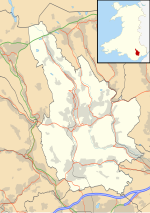
Penmain or Penmaen is a hamlet and community in Caerphilly county borough, south Wales, within the historic boundaries of Monmouthshire. It is situated in the Sirhowy valley, 3 miles (4.8 km) East of Blackwood. It is contiguous with, if not completely encompassed by, the larger village of Oakdale, which forms most of the community urban area. Penmain is an anglicisation of the Welsh language name Penmaen, meaning quite simply "headland" or "outcrop" (a common element in Welsh placenames: literally, rock/stone hill). Both spellings are found locally, with the English spelling predominant throughout the majority of the nineteenth and twentieth centuries, but the Welsh spelling is the one now more generally used.

Excerpt from the Wikipedia article Penmaen, Caerphilly (License: CC BY-SA 3.0, Authors, Images).

Penmaen, Caerphilly
Underwood Road,

Geographical coordinates (GPS) Address Nearby Places
placeShow on map

Wikipedia: Penmaen, CaerphillyContinue reading on Wikipedia

Geographical coordinates (GPS)

Latitude Longitude
N 51.670339 ° E -3.179917 °
placeShow on map

Address

Underwood Road

Underwood Road
NP12 0DW , Woodfieldside
Wales, United Kingdom
mapOpen on Google Maps

Penmain Chapel and gravestones geograph.org.uk 764899
Share experience

Nearby Places

Oakdale Colliery
Oakdale Colliery

Oakdale Colliery was a coal mine located in the Sirhowy Valley, one of the valleys of South Wales. In the early years of the twentieth century the need for coal was growing both in America and Europe, and local business men in Wales were looking for new opportunities to fill the demand.Among these were a group known as the Tredegar Iron and Coal Company, made up of wealthy industrialists from the Maclaren, Markham, Pochin, Whitworth and Wyllie families. They decided to create a group of collieries in the Sirhowy Valley, which explorations had told them contained rich seams of " black gold." One of these was at the small rural hamlet of Rhiw Syr Dafydd. Work began clearing the site for the new colliery at Ty Mellyn, Oakdale, with the sinking of the pit in 1907. Waterloo shaft followed in 1911. The shafts, North (upcast), and South, were 626 and 650 yards deep respectively, and were the largest diameter shafts in South Wales at the time.Opened in 1911, the colliery was owned by the Oakdale Navigation Collieries Ltd, a subsidiary of the Tredegar Iron Company. At its peak in 1938 it employed a workforce of 2,235, when production reached one million tons per year. Oakdale was linked to Markham colliery and the Celynen North colliery in Newbridge in the late 1970s and early 1980s, making it the largest colliery in Gwent. The pit closed in 1989 and the tips have now been landscaped and converted into platforms for industrial development.The former site of Oakdale Colliery now sites Islwyn High School, which opened in 2016 to former students from Oakdale Comprehensive School, Pontllanfraith Comprehensive School and Cwmcarn Comprehensive School. Of the three, the Pontllanfraith school is the only one still standing, with no obvious plans in sight.