place

El Camino Real de los Tejas National Historic Trail

2004 establishments in Louisiana2004 establishments in TexasColonial United States (Spanish)Historic trails and roads in LouisianaHistoric trails and roads in Texas
National Park Service areas in LouisianaNational Park Service areas in TexasProtected areas established in 2004Spanish Texas
El Camino Real Map
El Camino Real Map

The El Camino Real de los Tejas National Historic Trail is a national historic trail covering the U.S. section of El Camino Real de Los Tejas, a thoroughfare from the 18th-century Spanish colonial era in Spanish Texas, instrumental in the settlement, development, and history of Texas. The National Park Service designated El Camino Real de los Tejas National Historic Trail as a unit in the National Trails System in 2004. The modern highways Texas 21 (along with Texas OSR) and Louisiana 6 roughly follow the original route of the trail.

Excerpt from the Wikipedia article El Camino Real de los Tejas National Historic Trail (License: CC BY-SA 3.0, Authors, Images).

El Camino Real de los Tejas National Historic Trail
Cedar Street, Austin

Geographical coordinates (GPS) Address Nearby Places
placeShow on map

Wikipedia: El Camino Real de los Tejas National Historic TrailContinue reading on Wikipedia

Geographical coordinates (GPS)

Latitude Longitude
N 30.30077 ° E -97.7351 °
placeShow on map

Address

Cedar Street 3710
78705 Austin
Texas, United States
mapOpen on Google Maps

El Camino Real Map
El Camino Real Map
Share experience

Nearby Places

Shadow Lawn Historic District (Austin, Texas)

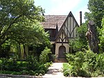
The Shadow Lawn Historic District is a historic district in central Austin, Texas that has a cohesive collection houses built in the southeast portion of Hyde Park during the late 1920s and 1930s. Roughly bounded by 38th Street, 39th Street, Avenue G, and Duval Street, the district includes several homes of historic interest from the turn of the twentieth century, including the Col. Monroe M. Shipe House, Hildreth-Flanagan-Heierman House, Frank M. and Annie G. Covert House, Page-Gilbert House, Smith-Marcuse-Lowry House, and the Oliphant-Walker House. This subdivision was platted by Hyde Park founder Monroe M. Shipe and indicated by concrete markers, some of which still stand today. Shipe's own home is located at the corner of 39th Street and Avenue G. The district was added to the National Register of Historic Places in 1990.Shadow Lawn's historical significance stems from the architecture of its houses. The district features a number of dwellings with modest Tudor Revival detailing characteristic of historicist "cottage" bungalows built in the 1930s. The dominance of this architectural form is an important feature that distinguishes the district from nearby housing clusters, as no other area in the northern suburbs of Austin contains as high a concentration of Tudor Revival dwellings. Unlike the bungalows in the nearby Hyde Park Historic District, these houses utilized more expensive masonry veneer rather than cheaper wood siding.