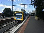
Pennydale, Victoria
Pennydale is a neighbourhood in the suburb of Cheltenham in Melbourne, Victoria, Australia, approximately 19 km south-east of the Melbourne central business district. Pennydale is that part of Cheltenham lying between Bay Road to the north, Jack Road to the west, Park Road to the south, and the Frankston railway line, and is entirely within the local government area of the City of Bayside. To the north-east of Pennydale, on the opposite side of the railway line and within Cheltenham, is the Westfield Southland shopping centre, which was opened in 1968. It has been expanded in a number of stages over the years, including a bridge, containing shops, across the Nepean Highway.
Excerpt from the Wikipedia article Pennydale, Victoria (License: CC BY-SA 3.0, Authors).Pennydale, Victoria
Luxmoore Street, Melbourne Cheltenham
Geographical coordinates (GPS) Address Nearby Places Show on map
Geographical coordinates (GPS)
| Latitude | Longitude |
|---|---|
| N -37.96 ° | E 145.04611111111 ° |
Address
Luxmoore Street
Luxmoore Street
3192 Melbourne, Cheltenham
Victoria, Australia
Open on Google Maps


