place

Westfield, Massachusetts

1660 establishments in the Massachusetts Bay ColonyCities in Hampden County, MassachusettsCities in MassachusettsPopulated places established in 1660Russian-American culture in Massachusetts
Russian communities in the United StatesSpringfield metropolitan area, MassachusettsUkrainian communities in the United StatesUse mdy dates from August 2016Westfield, Massachusetts
Westfield park square july 05 2012

Westfield is a city in Hampden County, in the Pioneer Valley of western Massachusetts, United States. Westfield was first settled by Europeans in 1660. It is part of the Springfield, Massachusetts Metropolitan Statistical Area. The population was 40,834 at the 2020 census.

Excerpt from the Wikipedia article Westfield, Massachusetts (License: CC BY-SA 3.0, Authors, Images).

Westfield, Massachusetts
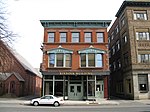
Franklin Street, Westfield

Geographical coordinates (GPS) Address Nearby Places
placeShow on map

Wikipedia: Westfield, MassachusettsContinue reading on Wikipedia

Geographical coordinates (GPS)

Latitude Longitude
N 42.125 ° E -72.75 °
placeShow on map

Address

Franklin Street 41
01085 Westfield
Massachusetts, United States
mapOpen on Google Maps

Westfield park square july 05 2012
Share experience

Nearby Places

Westfield Center Historic District

The Westfield Center Historic District is a historic district encompassing 157 acres (64 ha) of the civic, commercial, and industrial heart of Westfield, Massachusetts. It represents a major expansion of the Westfield Center Commercial Historic District, which included only two blocks of buildings along Elm Street in downtown Westfield. The district includes buildings representing the city's growth in the 19th century as a center of the whip-making industry, and its early years as a center for statewide educational institutions, as well as its growth as a regional center of western Hampden County. The commercial district was added to the National Register of Historic Places in 2008; the expansion and renaming of the district took place in 2013.Westfield was settled in the 17th century by English colonists, with its town center forming just west of the confluence of the Westfield and Little Rivers. It was mainly agricultural until the early 19th century, when whip making began as a cottage industry, and the Hampshire and Hampden Canal provided reliable means for moving goods. The town center shifted westward around this time, becoming centered between Park Square and the Westfield River on what is now called Elm Street. The town developed a diverse industrial whose largest component was the whip industry, prompting it to be called "Whip City". That industry would predominate until the advent of the automobile in the 20th century greatly reduced demand. In the late 19th century the city also became home to the state's second normal school, now Westfield State University.The city center is architecturally reflective of much of this history, although buildings from the late 19th and early 20th centuries predominate. Important industrial elements survive, in particular whip factories that include the Sanford Whip Factory, the Westfield Whip Manufacturing Company, the United States Whip Company Complex. The early functions of the normal school are recalled in part by the Westfield Municipal Building (formerly housing that school, and now city hall), and the State Normal Training School, an elementary school built as a training vehicle for teachers in training. Residential neighborhoods developed on either side of the commercial area, portions of which are included in the historic district.

Westfield Municipal Building

Westfield Municipal Building is a historic building at 59 Court Street in Westfield, Massachusetts. It presently houses the Westfield city offices and the local district court. It was built in 1889 to house the state normal school (now Westfield State University), serving in that role until its acquisition by the city in 1959. The building was designed by the architectural firm of Hartwell and Richardson. The second partner was William Cummings Richardson, not H. H. Richardson, but the design of this building, only a few years after the latter's death, was strongly influenced by his distinctive style.The building has an L shape, with a front facade of 140 feet (43 m). The main block is 65 feet (20 m) deep, and the ell extending off the east side is 55 feet (17 m) deep. It rests on a granite foundation, and is made of red brick with brownstone trim. There are two entrances on the front facade, each under classic Richardsonian arches, with additional entrances on the east side and the rear. In its first use as a training school, the first floor included a reception area, science classrooms, and training classrooms for elementary grades. The second floor housed a study hall and assembly hall capable of holding the whole student population (about 175), as well as the principal's office, science laboratories, other classrooms, and studio space for artistic disciplines. There was a gymnasium in the basement.The exterior of the building received only modest modifications when the city took over the building in 1959, although it was extensively remodeled inside. Two brick additions were added, one on the east side as vault space, and the other on the north side for storage. The entrance formerly used by the school now serves as the district court entrance, providing access to the clerk's office, a courtroom, and probation offices. The remainder of the building has been converted for the use of a number of city departments.The building was listed on the National Register of Historic Places in 1978, and as part of an expanded Westfield Center Historic District in 2013.