place

North Adams, Massachusetts

1745 establishments in the Province of Massachusetts BayCities in Berkshire County, MassachusettsCities in MassachusettsNorth Adams, MassachusettsPopulated places established in 1745
Use mdy dates from July 2023
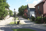
Main Street North Adams

North Adams is a city in Berkshire County, Massachusetts, United States. It is part of the Pittsfield, Massachusetts Metropolitan Statistical Area. Its population was 12,961 as of the 2020 census. Best known as the home of the largest contemporary art museum in the United States, the Massachusetts Museum of Contemporary Art, North Adams has in recent years become a center for tourism, culture and recreation.

Excerpt from the Wikipedia article North Adams, Massachusetts (License: CC BY-SA 3.0, Authors, Images).

North Adams, Massachusetts
Lamoureaux Place,

Geographical coordinates (GPS) Address Nearby Places
placeShow on map

Wikipedia: North Adams, MassachusettsContinue reading on Wikipedia

Geographical coordinates (GPS)

Latitude Longitude
N 42.7 ° E -73.116666666667 °
placeShow on map

Address

Lamoureaux Place 3
01247
Massachusetts, United States
mapOpen on Google Maps

Main Street North Adams
Share experience

Nearby Places

North Adams Museum of History and Science

The North Adams Museum of History and Science is located on State Street in North Adams, Massachusetts as part of Western Gateway Heritage State Park. The building it inhabits was originally built in 1880 as a coal distribution center. The museum, however, was established by the North Adams Historical Society in 1988.The first floor of the museum contains exhibits on the Industrial Revolution, and its effects on what became an industrial center during the nineteenth and early twentieth centuries. This exhibit displays machine parts and goods of some of the major manufacturing companies in the town during this era: Hunter Machine Company, Arnold Printworks and Sprague Electric. This floor also contains artifacts that depict farming, education, and home life during this era. One can find a children’s room, North Adams school paraphernalia, city uniforms, and household objects. The second floor is particularly notable for its Freight Yard exhibit. A moving train set has been constructed to model the town of North Adams and its train system. In this room there are also exhibits on immigration, which highlights French, Lebanese, Welsh, Italian, Jewish, Irish, and Chinese immigration to the area; religion, mainly by showing the churches that have been built in North Adams; and ballooning. In an adjacent room exist displays on flora and fauna, geography (containing a topographical map of this area of the Berkshires), and a kids’ room relating to flora and fauna of the area. Finally, the third floor is centered on political and military history of the area. It contains a voting machine from the nineteenth century, information on past mayors of North Adams, information on military heroes of the area, and Native American artifacts of those who inhabited the area before the settlers. There is also a side room dedicated to Fort Massachusetts, an English fort in North Adams during the French and Indian War. Finally, there is also a blacklight gallery that is used as a display of the Solar System. The museum’s hours are Saturday 10AM-4PM and Sunday 1-4PM November through April, and Thursday through Saturday 10AM-4PM and Sunday 1-4PM May through October. The museum is closed on holidays.

Monument Square–Eagle Street Historic District

The Monument Square–Eagle Street Historic District is a historic district encompassing the civic heart of North Adams, Massachusetts. When it was originally designated in 1972, the district encompassed Monument Square – west of the intersection of Main Street and Church Street, and the location of a Civil War memorial – and the area around it. This designation included the North Adams Public Library (formerly the Blackinton Mansion), the First Baptist Church and First Congregational Church, and a block of shops Eagle Street. In 1988, the district's boundaries were increased to be roughly bounded by Holden, Center and Union Streets, the East Middle School (now the Silvio O. Conte Middle School), Summer Street, and Main Street. This expansion extended the district westward along Summer Street to include the US Post Office building and St. John's Church, and eastward to include Colgrove Park, the middle school, and St. Francis Catholic Church. An additional block of commercial buildings was also added on the north side of West Main Street, extending just west of Holden Street.North Adams was settled as part of Adams in the mid-18th century, and soon developed as an industrial village, powered by the waters of the two branches of the Hoosic River, which meet just northwest of its central business district. The waterfront areas were developed with mills producing a variety of goods, which were eventually dominated by textiles beginning in the mid-19th century. The central business district around Monument Square, were the town's Baptist Church was founded in 1808, led by Otis Blackinton, whose family would dominate the local industrial business landscape. Most of the city's business district was developed between about 1870 and 1920, the greatest period of its economic success. A major decline was begun by the Great Depression, resulting in little growth in subsequent decades.

Hillside Cemetery (North Adams, Massachusetts)

Hillside Cemetery is a historic cemetery on West Main Street (Massachusetts Route 2) between Brown Street and Charles Street in North Adams, Massachusetts, United States. Located on the western fringe of the city, the earliest portions of the cemetery date to 1798; it is the community's oldest public burying ground. The cemetery is divided by Route 2, with the older section to the north and the younger section (laid out in 1858) to the south. The cemetery's location at the foot of Mount Greylock gives it excellent views of the surrounding area, and of the urban core of North Adams.The older portion of the cemetery is less formally laid out than the newer section. It includes a fairly steeply sloped hill and a bowl-shaped valley, and is lined by grassy paths laid out in a grid. The oldest graves are at the top of the hill, the oldest dating to 1798. The southern portion of the cemetery is much larger, and is laid out with narrow roadways, most of which were in place by 1878. The terrain of the southern section is similar to that of the northern, also featuring a hill and valley. The most prominent memorial is the Tinker Mausoleum (1926), located in the northern section.The oldest surviving cemetery in North Adams is the Old Congregational Burying Ground (1780). Hillside appears to have been established as a family cemetery of the locally prominent Knight family, who buried their daughter Olive in 1798. Members of the Knight family were among the first to introduce textile manufacturing into North Adams, its early source of growth and prosperity in the 19th century. The town of Adams (from which North Adams separated in 1878) purchased the southern tract in 1858. North Adams' second public cemetery, located in the southern part of the city, was opened in 1898.The cemetery was listed on the National Register of Historic Places in 2001.